Interview with Paul and Elizabeth Huffman: Insights into a Historic Tornado Photograph

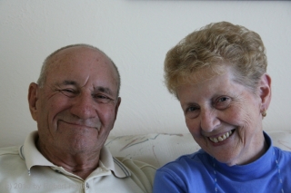
Meet Paul “Pic” Huffman and his wife, Elizabeth. A very photogenic couple, wouldn’t you say? And, I might add, a lovely one–two very nice, warm people who welcomed me into their house near Elkhart, Indiana, yesterday for a conversation I’ve been looking forward to a long, long time.

Forty-five years ago, on the evening of April 11, 1965, Paul and Elizabeth were homeward bound on US 33 when Elizabeth spotted what looked like a column of smoke off to the west. “Look at that smoke,” she told Paul. “Something’s burning.”

“That’s not smoke,” Paul replied.

Pulling the car off onto the shoulder, he grabbed his camera out of the back seat. Then, scrambling out of the vehicle and hooking his leg around the front bumper to steady himself in the wind, Paul Huffman began snapping photos as a tornado moved across the field, broadening and intensifying on its rapid journey toward the Midway Trailer Park less than half a mile up the road.

One of Paul’s photos, taken as debris from mobile homes exploded skyward, became not only the instant icon of the second worst tornado outbreak in Midwestern history, but also what is undoubtedly the most famous tornado photograph of all time. With the emotional impact peculiar to black-and-white photography, Paul’s photo depicts twin funnels straddling US 33 like a pair of immense, black legs. It is a chilling image, instantly recognizable to anyone interested in tornado research or severe weather history.

Researching for a book I’m writing on the 1965 Palm Sunday Tornadoes, I’ve come across several variations of Paul’s story by different writers. The discrepancies have been enough to leave me feeling frustrated. The Huffmans’ account strikes me as integral to a book on the outbreak, and as a matter of both responsible writing and simple respect, I’ve wanted to learn the facts and offer as accurate a writeup as possible. I was delighted last year, then, to learn that Paul would be one of the featured speakers at a Palm Sunday Outbreak commemorative event at the Bristol Museum.

Of course I attended the commemoration, where I connected with my friends Pat Bowman and Debbie Watters (my two “tornado ladies”) and also met Paul and Elizabeth for the first time. It was then that I requested an interview. Now, a year-and-a-half later, I finally got the opportunity.

When I arrived at their house, the Huffmans were standing outside surveying damage to their property from the previous day’s derecho. A small tree was down, a flagpole had gotten blown over, and a lot of tree litter had filled the yard. It seemed ironic that I was meeting Paul and Elizabeth on the wings of another bad storm.

They invited me inside, and we had a great chat that covered a lot more ground than just the tornadoes. In their early 80s, the Huffmans are an engaging twosome with plenty of stories to share. Paul, who served as a reporter for the Elkhart Truth, regaled me with several accounts from back in the day, including a flyover directly over a smokestack of the newly built Cook nuclear power plant, and a humorous mishap on the roof of a quonset hut. But of course, the main focus was his experience with the Midway tornado.

I won’t go into details here because it’s been a long day and I’m tired, and besides, I haven’t had a chance to review the interview tape. But here are a few noteworthy highlights:

* Paul never saw the twin funnels when they occurred. He was too busy snapping pictures, and he saw only the rightmost funnel in his viewfinder. Not until later, when he developed his film in his darkroom at home, did he realize what an unusual image he had captured.

* Among the larger pieces of debris raining around the Huffmans’ vehicle was a car which got flung overhead and landed on the other side of the railroad tracks that parallel US 33.

* The Huffmans never heard any of the tornado forecasts that were broadcast that day. But Paul, working outdoors earlier in that balmy afternoon sunshine, sensed that bad weather was on the way and mentioned it to Elizabeth.

* Ted Fujita interviewed the Huffmans at their house. Paul said that during his visit, Fujita seemed, oddly enough, to be more interested in Saint Elmo’s fire than in the tornado.

Paul’s overall work as a photojournalist won him a number of awards, but I’m sure that he and Elizabeth would agree that it was his one remarkable, serendipitous photograph of “The Twins” that gained him fame, if not necessarily fortune. It is strange to think how an ordinary, down-to-earth man can find himself in the right place at the right time, doing what he was designed to do–in Paul’s case, taking photographs–and wind up having an impact that shapes lives and vocations. It’s impossible to say how many people have been affected by Paul’s powerful and horrifying photo of the Midway tornado, but I know that it has helped to inspire a few notable careers in meteorology and media, not to mention many a storm chaser. It was a treat to finally get to sit down and talk with the man who took that picture, and to enjoy him and his wife not merely for their fascinating account, but also for the fine, intelligent, humorous, hospitable people that they are.
June 5 Storm Chase: Illinois Tornado Outbreak

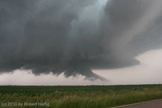
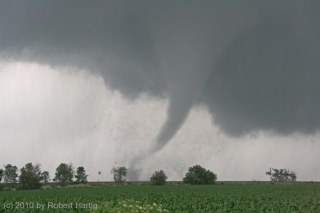
We were close to the tornado, roughly a quarter mile south of it, paralleling it as it tore an eastward course through the Illinois fields. Dirt and shredded corn swirled around its base like an aura. As Kurt Hulst and I  pulled aside and stepped out of the car to take pictures, we could hear the roar. It wasn’t loud, just audible and big, very big, an intensely focused sound like an immense blowtorch or a rocket engine. Yet, close as Kurt and I were to the tornado, we were out of its path and beyond the range of any apparent debris, and I sensed no particular danger.

A brief staccato of blue flashes suddenly lit up the base of the funnel, accompanied by a loud bang, and chunks of debris flew skyward and centrifuged out. The tornado had hit a structure out in the field, most likely an outbuilding of some kind.

Fortunately, there was little real harm the twister could do out there in the broad Illinois prairie. Not yet, anyway. But a little way to the east lay Yates City, and two-and-a-half miles farther, the community of Elmwood…

The day had started off rather inauspiciously, with the previous evening’s aggressive SPC outlook degrading into a forecast for straight-line winds. The 12Z NAM, too, looked unpromising, and the RUC corroborated it, with mostly southwesterly surface winds veering with height to a unidirectional, westerly mid- and upper-level flow. A persistent batch of cloud cover from a mesoscale convective system threatened to minimize daytime heating and instability. In a word, the setup wasn’t one that suggested tornadoes.

But with a trough digging in from the west, rich moisture, great shear, and at least a semblance of clearing moving in from the southwest, Kurt and I decided to chance it anyway. Our friend and fellow Michigan chaser Ben Holcomb had alerted us the previous evening to the evolving weather situation, and after reading Friday night’s Day 2 Convective Outlook and scanning the NAM, which showed an impressive juxtaposition of the right ingredients, including high helicities stretching along I-80 from Iowa into Indiana, we knew that we had to go.

So off we headed for Illinois late Saturday morning. As Kurt pointed out, the forecast models don’t always have a good grasp on things. One thing we could tell from both the NAM and RUC, though, was that the best parameters now lay well south of I-80. Accordingly, we set our sights on Galesburg, and once there, we continued on, crossing the river at Burlington and heading west into Iowa.

I took a dewpoint reading of over 72 degrees on my Kestrel at New London. The air was juicy. But the clearing we had driven through in western Illinois was giving way to a an extensive mid-level cloud deck. Rather than continuing to forge farther west toward the cold front, we decided to backpedal eastward in the hope that convection would fire near the edge of the cloud shield. This idea became a moot point as the cloud cover rapidly expanded across the river into Illinois.  But better parameters still lay in our area. We were presently in an area of maximum sigtors and optimal 1 km helicity, and on the radar, a scattering of blue popcorn echoes suggested that localized convection was trying to get started. Anticipating that these features would all translate to the east, we drifted back in that direction.

We soon noticed a cloud base with a tower reaching up toward the higher cloud deck. It showed on the radar, as did another stronger one directly down the road from us. As we headed toward it, the second echo progressed from yellow to red. Not far to our northeast, we could see a rain curtain. Skirting it, we moved east of the developing storm cell, parked, and got our first good look at it.

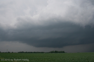
The cell was organizing nicely and was already showing supercellular characteristics–nice separation of the  saucer-like updraft base from the precipitation core; a strong, crisp, tilted updraft tower; the first signs of banding, and a hint of an inflow stinger. Positioned on the southeast edge of the convective cluster in southeast Iowa, it was in a favorable position to

ingest moist inflow unimpeded by other storms as it drifted at 30 knots toward Illinois.

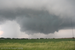
This was our storm. We tracked with it back across the river, watching it develop, watching the base lower and the first hint of a wall cloud blossom and put on muscle, watching it tighten as the RFD notch wrapped around it.

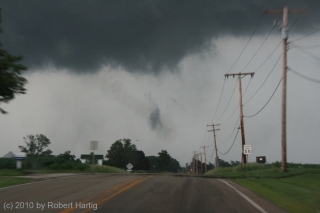
Just southeast of  Maquon, Illinois, we saw it: a cloud of dust billowing up from the ground with brief, streaming tendrils of condensation forming and dissipating above it. Tornado! It was a brief appearance of maybe a minute’s duration, but the storm was just getting started, mustering energy for the next round.

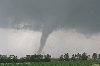
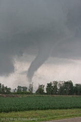
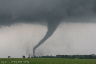
We didn’t have long to wait. A minute or two later, as we proceeded down CR 8, a slender elephant’s trunk of a funnel probed its way earthward, intensified, and began gobbling its way through the corn, closing in to within a quarter-mile of us before turning straight east.

This turned out to be a beautiful, highly photogenic tornado, all the moreso for the amazing display of lightning that accompanied it. Kurt took some great video of it which will give you a much better appreciation for how

electrified the tornadic environment was. At one point, at the 8:50 mark, you can see a bolt shoot directly from the funnel to the ground. I didn’t have the good fortune to witness the famed Mulvane, Kansas, tornado, but I’ve got to believe that this storm was similar in terms of its incessant lightning.

The funnel morphed through a variety of elegant formations, and the overall storm structure was beautiful. It was a stunning and mesmerizing sight, but with growing concern, Kurt and I realized that it was making its way toward Yates City and didn’t show any sign of weakening.

Fortunately, the funnel veered slightly to the northeast, passing just to the north of the town. At that point, it was an intense drillpress spinning furiously a mile distant. We closed the gap and tracked with it as it headed toward the larger town of Elmwood, just a couple miles down the road.

What was the funnel doing? It appeared to be shifting to the right. Oh my gosh! Elmwood was going to get hit! The tornado was beginning to rope out,

but not in enough time to spare the town. Taking a hard right, it plowed through the town center. Three-quarters of a mile ahead of us, power lines arced and transformers exploded, debris blasted into the air, and a large dust cloud billowed skyward.

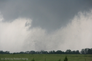
It is a weird and awful feeling to witness a community get hit by a tornado. I’ve seen it happen twice before in Springfield, Illinois, and in Iowa City, but those were night time events. It’s different in broad daylight, when you can see what’s happening. The rather blurry photo shown here was taken just before the tornado crossed Main Street in downtown Elmwood. It’s not a very dramatic shot. You can see a few pieces of debris floating in the air and no more than a cloud tag to mark the presence of the tornado. But a second or two after the photo was taken, things got very nasty in that town. If there’s anything at all good to be said about what happened there, it’s that no one got killed or, as far as I’m aware, even injured.

A couple hundred yards south of Elmwood, the tornado dissipated. Gone, poof, vanished just like that. There’s a certain ugly irony about a force of nature that can wreak havoc in a community and then vanish a few seconds later without a trace. If the tornado had dissipated just thirty seconds sooner, a lot of people might have experienced just a good scare rather than a local disaster.

Kurt and I continued tracking with the storm as it made its way toward Peoria. The next tornado soon formed–a larger, bowl-shaped cloud with multiple vortices. This broadened out into a large tornado cyclone with multiple areas of rotation that produced, among other things, a brief but spectacular horizontal vortex. Sorry, I have no photos to show of it. It had gotten too dark, we were moving, and any picture I took at that point would have been blurred beyond recognition.

In Peoria, we got a bit snagged by roads and traffic, but thanks to Kurt’s great driving, we soon found ourselves heading east on I-74. As we crossed the Illinois River, I could see what appeared to be a large cone funnel to our north making its way across what was probably Upper Peoria Lake, silhouetted by frequent strobes of lightning.

Catching CR 115 at Goodfield, we headed north to Eureka, then continued east along US 24. We were still tracking with the storm, which was slowly weakening as the next tornadic supercell to its north began to dominate. It was still no pansy-weight, though, and at Chatsworth, in a final show of strength, it spun down a brief but well-defined rope tornado.

As our storm merged with the northern storm around Kankakee, Kurt and I caught I-57 and headed home. After May 22 in South Dakota, I really didn’t expect that I’d get another decent storm chase in. But this El Nino year, which got off to such a rotten start for storm chasers, now is paying dividends with some highly photogenic tornadoes.

And the season isn’t over yet. There’s no telling what the rest of June may hold. I doubt I’ll be making any more forays this year into the Plains, but if the Great Lakes region continue to light up, I’ve got my camera and laptop ready.

To see more photos from this chase, click here. And while you’re at it, check out the rest of my images of storms, tornadoes, wildflowers, people, and whatnot in my photos section.

Remembering the Parkersburg/Hazleton Tornadoes

One year ago today, the second EF5 tornado in the history of the new Enhanced Fujita Scale rating system descended on Parkersburg, Iowa, and obliterated the southern third of the town. I and fellow storm chasers Bill and Tom Oosterbaan and Jason Harris could see the intense rotation moving over Parkersburg on GR3 as we stairstepped southeast from the northern edge of the cell, heading for an intercept. There’s a certain sense of disbelief when you see something like that, a feeling of, Naah, it can’t be as bad as it looks.

But it was. A few miles farther down the road, with the rotation still at least ten miles to our west, debris–some of it fairly large–began to fall from the sky. That was when we knew for sure. Something terrible had happened. Even with pieces of sheet metal clanging down onto the pavement in front of us, I had a hard time believing that a tornado disaster had just occurred, but I think we all felt a certain sober awareness that a community had been hit.

We intercepted the storm near Fairbank, where the NWS indicates that the Parkersburg tornado occluded. Parking on a sideroad, we watched as a large, new wall cloud formed and moved directly toward us. Warning an Amish family who was standing in their yard, watching, to take shelter, we scooted south and then east, watching as the wall cloud lowered and kicked up a ton of dust. A second, enormous tornado had formed, barely discernible through the haze. We tracked with it to the east as it headed on a collision course for Hazleton, mercifully grazing the southern edge of that town. Had it hit head-on, I suspect that the Hazleton tornado’s EF3 rating would have been higher.

It’s hard to believe that a whole year has passed since that event and the several days of Great Plains action that preceded it. What a difference between then and now, with a nasty ridge casting a pall on this May’s peak chase season.

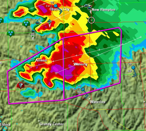
In remembrance of the Parkersburg/Hazleton tornadoes, I’m including a couple visuals. The first is a radar grab of the supercell as it moved out of Parkersburg. The tornado icon is a storm report from the town, just minutes old. You can see our GPS position marked by a circle with a dot in the middle of it on the northeast edge of the storm

The Parkersburg, Iowa, tornadic supercell.

The Parkersburg, Iowa, tornadic supercell.

The second is this YouTube link to my video of the Hazleton tornado. My videography may not be the best in the world, but I think you’ll get a sense of the intensity this storm evoked. It was my first really big tornado, and it was close.

I doubt this year has anything in store for us  like what we saw that day. But who knows? I’m not ready to write off this chase season yet–though I certainly hope it doesn’t hold a catastrophe like the Parkersburg tornado.

Highlights of the 1965 Palm Sunday Tornado Memorial in Bristol, Indiana

Yesterday I made the drive to the Elkhart County Historical Museum in Bristol, Indiana, to attend the forty-fourth memorial observance of the 1965 Palm Sunday Tornadoes. The occasion may have been low-key, but it was nevertheless remarkable. A couple of the factors that made it so were purely personal. I finally got to meet my long-distance friend and owner of the Tornado Memorial Park in nearby Dunlap, Debbie Watters. We’ve connected so well across the miles via email that when we finally got to talk person to person, it was as natural as if we’d hung out together forever. It was a double pleasure to meet her daughter and husband as well.

Then there was my other “tornado lady” friend, Pat McIntosh, who attended the meeting with her brother, John. What a sweetie! The three of us caught dinner afterward near Middlebury.

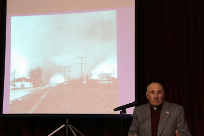
The stories and memories were amazing, and some quite touching and emotional. One huge highlight for me is captured in the photos below. In the first photo, the image shown on the projector screen depicts the notorious twin funnels that swept through the Midway Trailer Park south of Dunlap, Indiana. The image is one of the most famous tornado photographs ever taken, and the man standing next to it is the person who took it, retired Elkhart Truth newspaper photographer Paul Huffman.

Paul Huffman stands next to a projection of his Pulitzer Award-winning photo of the Midway twin funnels.

Paul Huffman stands next to a projection of his Pulitzer Award-winning photo of the Midway twin funnels.

Paul and his wife were traveling north on US 33 shortly after 6:00 p.m. on April 11, 1965, when they spotted the tornado moving in from the southwest. Stopping the car, Paul grabbed his camera and snapped a series of six dramatic photographs as the tornado morphed from a narrow funnel into the two-legged monster that devastated the hapless trailer court, then moved off to the northeast in a cloak of rain.

How fast was the tornado moving, I wanted to know. Fast, Paul said. Probably seventy miles an hour. How close was he, someone else asked. Around a quarter-mile. Were he and his wife at all close to the debris? An ironic smile. Yes, his wife replied, the two of them experienced some debris falling around them. Would a flattened automobile qualify?

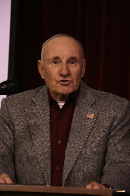
Paul Huffman speaks at the 2008 memorial observation of the 1965 Palm Sunday Tornadoes.

Paul Huffman speaks at the 2008 memorial observance of the 1965 Palm Sunday Tornadoes.

One powerful moment occurred after the event had officially ended and people were milling around the tables full of memorabilia. My friend Pat was showing me a photo Paul had taken during rescue operations at the trailer court. In the photo was a young Pat, laying on a stretcher. Over her hovered her husband, Bill. To the right stood a fireman.

As we looked at the photo, an elderly gentleman standing nearby named Dwight Kime said, “That fireman was my brother-in-law.” Dwight himself had been one of the rescue workers. As it turned out, he was the one who found Pat and Bill’s baby, Chris, amid the rubble–one of the youngest of the ten fatalities in the trailer court. Dwight was visibly moved as he came to understand that Pat had been the child’s mother. It has been forty-four years since that terrible evening, but the memories–and the hidden sadness–never fade. I am glad that Pat’s little boy was found and cared for in death by such a tenderhearted man as Dwight Kime. And I am just as glad that, after all these years, he and Pat got to meet and talk at last. That is God’s grace.