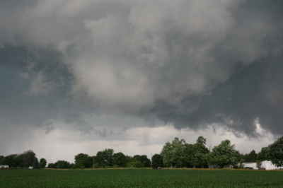
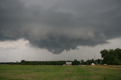
Intercepting the March 2, 2012, Palmyra-Henryville-Marysville, Indiana, Tornado

Now, while my video from Friday’s chase is uploading to YouTube, is a good time for me to write my account of how things transpired down in southern Indiana.

The phrase “historic event” rarely describes something good when applied to severe weather. March 2 may qualify as a historic event. The current NOAA tally of tornado reports stands at 117; the final number, while likely smaller once storm surveys have been completed and multiple reports of identical storms have been consolidated, may still set Friday’s outbreak apart as the most prolific ever for the month of March. Whether or not that proves true, Friday was unquestionably a horrible tornado day that affected a lot of communities from southern Indiana and Ohio southward.

The Storm Prediction Center did an excellent job of keeping track of the developing system, highlighting a broad swath of the eastern CONUS for a light risk in the Day Three Convective Outlooks and upgrading the area on Day Two to a moderate risk. On Day One, the first high risk of 2012 was issued for a four-state region that took in southern Indiana and southwest Ohio, most of Kentucky, and north-central Tennessee–a bullseye in the middle of a larger moderate risk that cut slightly farther north and east and swept across much of Mississippi and Alabama as well as northwestern Georgia.

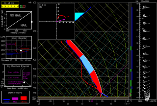
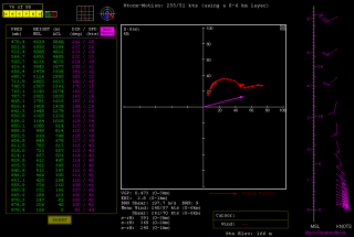
The SPC and NWS offices weren’t the only ones keeping vigilance. Storm chasers across the country were watching the unfolding scenario, among them being my good friend Bill Oosterbaan and me. Here are the February 29 00Z NAM model sounding and hodograph for March 2, forecast hour 21Z, at Louisville, Kentucky. (Click on the images to enlarge them.) With MLCAPE over 1,800 J/kg, 0-6 km bulk shear of 70 knots, and 1 km storm-relative helicity at 245 m2/s2, the right stuff seemed to be coming together. By the time the storms actually started firing, those figures were probably conservative, particularly the low-level helicity, which I recall being more in the order of 400 m2/s2 and up. Simply put, the region was going to offer a volatile combination of moderate instability overlaid by a >50-knot low-level jet, with a 100-plus-knot mid-level jet core ripping in.

I had my eyes set on southeastern Indiana. The problem with that area is, it’s lousy chase terrain along the Ohio River, and it doesn’t improve southward. If there was an ace-in-the-hole, it was Bill’s knowledge of the territory, gleaned from his many business trips to Louisville.

We hit the road at 7:15 that morning, stopping for half an hour in Elkhart so Bill could meet with a client and then continuing southward toward Louisville. Bill was of a mind to head into Kentucky, where the EHIs and CAPE were higher; I was inclined to stay farther north, closer to the jet max, the warm front, and, presumably, stronger helicity. But either choice seemed likely to furnish storms, and since Bill was driving, has good instincts, and knows and likes western Kentucky, I was okay with targeting the heart of the high risk rather than its northern edge.

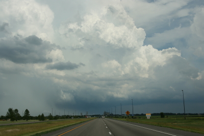
But that plan changed as we drew near to Louisville. By then, storms were already firing, and one cell to our southwest began to take on a classic supercellular appearance. Bill was still for heading into Kentucky at that point, but after awhile, a second cell matured out ahead of the first one. We now had two beautiful, classic supercells to our southwest, both displaying strong rotation. It was a case of the old adage, “A bird in the hand is worth two in the bush”–except in this case, there were two birds, back to back. And I-64 would give us a clear shot at both of them.

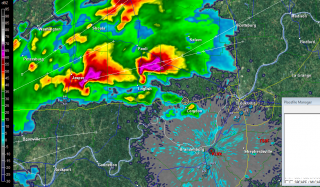
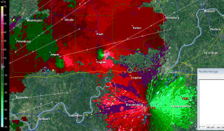
So west we went, and into chase mode. At the Corydon exit, we caught SR 135 north, headed for an intercept with the first supercell. The two radar captures show the base reflectivity and SRV shortly after we began heading up the state road.

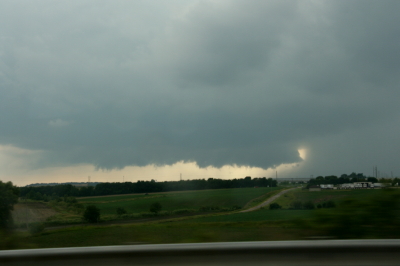
A few miles south of Palmyra, we got our first glimpse of a wall cloud maybe four miles distant. That’s all there was at that point, and the hilly, forested terrain afforded less-than-optimal viewing. Within a minute or two, we emerged into an open area just in time to see a funnel descend from the cloud. Tornado!

The sirens were sounding in Palmyra, providing an eldritch auditory backdrop to the ropy funnel writhing in the distance as we drove through town. The tornado went through various permutations before expanding into a condensation cone revolving like a great auger above the treeline. It was travelling fast–a good 60 miles an hour, at a guess. As we sped toward it, the condensation hosed its way fully to the ground and the tornado began to broaden. It crossed the road about a half-mile ahead of us, continuing to intensify into what appeared to be a violent-class tornado with auxiliary vortices wrapping around it helically.

Shortly after, Bill and I came upon the damage path. We pulled into a side road lined with snapped trees, amid which a house stood, somehow untouched except for a number of peeled shingles. The tornado loomed over the forest beyond, an immense, smoky white column wrapping around itself, rampaging northeastward toward its fateful encounters with Henryville and Marysville.

The time was just a few minutes before 3:00 eastern time. While I prepared and sent a report to Spotter Network, Bill turned around and headed back south. We had another storm to think about, and it was closing in rapidly. It wouldn’t do to get caught in its way.

Back in Palmyra, we headed west and soon came in sight of another wall cloud. This storm also reportedly went tornadic, but it never produced during the short time that we tracked with it. We lost it north of Palmyra; given the topography, the roads, and the storm speed, there was no question of chasing it.

From that point, we headed south across the river into Kentucky to try our hand at other storms, but we saw no more tornadoes, nor, for that matter, much in the way of any serious weather. Not that there weren’t plenty more tornado-warned storms; we just couldn’t intercept them, and after giving it our best shot, we turned around and headed for home.

Lest I forget: my worst moment of the chase came when I couldn’t locate my video of the tornado in my camera’s playback files. It seemed unfathomable that I could have horribly botched my chance to finally capture decent tornado footage with my first-ever hi-def camera. After being miserably sidelined during last year’s record-breaking tornado season, the thought that I had somehow failed to record this day’s incredible intercept just sickened me. Fortunately, there were no sharp objects readily available; and better yet, the following morning I discovered that I had simply failed to scroll up properly in the playback mode. All my video was there, and it was spectacular. Here it is:

My excitement over the video was offset by reports of just how much devastation this tornado caused eighteen miles northeast of where it crossed the road in front of Bill and me. Henryville, obliterated. Marysville, gone. Eleven lives lost in the course of that monster’s fifty-two-mile jaunt. And similar scenarios duplicated in other communities across the South and East. The death toll for the March 2 outbreak presently stands at around forty.

In the face of a mild winter and an early spring, Friday was the inauguration for what may be yet another very active severe weather season east of the Mississippi. We can only hope that there will be no repeats of last year’s wholesale horrors. May God be with those have lost loved ones and property in Friday’s tornadoes.
Quick Summary of Wednesday’s and Thursday’s Chases

Five days and nearly 3,000 miles later, I’m back from out west. This storm system proved to be a disappointment, but it did have its moments. Bill Oosterbaan and I intercepted a nice low-topped supercell in northeast Kansas on Wednesday night, and it’s possible that we witnessed a brief tornado. I need to scrutinize the brief footage I got of the storm feature in question. What was unmistakable was the broader circulation of the storm. It seemed weird to be chasing a north-moving storm with inflow from the northeast, but that’s how it was with storms that moved along a warm front–apparently across it–near a low center with a 500 mb closed low in the vicinity.

Yesterday was a more typical setup. We targeted the Muskogee, Oklahoma, area, which the SREF and RUC pointed to as offering the best overlay of instability and mid-level support, with the H5 jet core nosing into the region.

We were right on the first storms as they initiated, but they were feeble things that just couldn’t seem to get their acts together. With a long drive home lying ahead of us, we concluded to start heading north and settle for a nice lightning show on the way home.

But our prospects improved as the 500 mb jet began to strengthen. A couple of cells to our west and northwest intensified and began to take on a telltale appearance on the radar. A handful of scans later, rotation started to manifest on SRV. By this time we were on US 59 north of the Grand Lake of the Cherokee, east of Vinita and directly in the path of the southernmost cell. At a side road, we pulled aside and I tripoded my camcorder and videotaped some nice storm features: pronounced beaver tail, tail cloud, a nasty-looking wall cloud, and a wet RFD notch.

Beginning as a classic supercell, the storm looked for a while like a tornado breeder. But after predictably morphing into an HP, it eventually lined out and got absorbed into the wad of convection springing up to its south. Lack of adequate helicity is probably what kept this and other storms non-tornadic. METARs showed backed surface winds in the vicinity of the storms, but from what I observed, surface inflow was non-existent to weak. Hodograph curvature doesn’t matter much if boundary layer wind speeds are puny.

I have a few photos to process that I’ll slap up in a day or two, possibly along with a radar grab or two. Right now, though, I’ve got some work I need to accomplish before the work week ends, so here’s where I sign off.

August Reminiscences: My First Successful Storm Chase

Ah, August. In its own way, it’s a lot like February: a month whose respective season of the year has settled in and ripened into predictability. Upper winds are weak and storms are often the pop-up type, providing a quick flash-and-bang along with localized rainfall before fizzling out. Yet on the horizon, like the first cirrus wisps of a fast-moving cold front, you can see change coming.

This morning I awakened to the distant grumble of thunder, and when I opened the drapes, the sky was an odd, fish-flesh paleness with darkness moving in. Oh, joy! Upon hearing me stir, Lisa stepped into the room with a smile and told me that a squall line was approaching. Now, that’s the way I like an August day to begin! I fired up the computer and consulted GR3. It was a skinny line, but the NWS was saying big things about it’s being quite the wind machine. Eight miles up the road, the KGRR station ob reported heavy rain; yet here in Caledonia, we got just a mild spray of precipitation, the lightning called it quits, and the line which had threatened to enter like a lion left like a lamb. Now it’s no longer even detectable on the radar.

More thunder is in the forecast for today, though, and for the next few days, as a weak warm front sloshes back and forth and as air mass storms generate more boundaries to fire up convection. It’ll be a bland but enjoyable show.

While my attitude toward August may seem patronizing, this month is capable of producing an occasional potent surprise. On August 24, 2007, I was sitting in the Hastings library when a line of storms formed just to the west and drifted directly overhead. I had my laptop with me with GR3 running, but my forecasting skills and overall experience were still pretty embryonic, and I dismissed some telltale signs, both radar and visual, because forecast models indicated a straight-line wind event.

The storms matured overhead, blasting Hastings with rain and lightning, and then moved to the east and steered an EF-3 tornado through the town of Potterville. I could have easily intercepted it if I had known what the heck I was doing. There it was, a perfect chase opportunity, gift-wrapped with a large ribbon and dropped smack into my lap, and I was too dumb to untie the bow. Aaargh! Four years later, I could still whap myself alongside the head.

But God showers his kindness even on the ignorant. My first successful chase was eleven years earlier, back in August of, I believe, 1996. I don’t remember the exact date, but I can assure you that in those days, cluelessness was a level of expertise I had yet to attain. However, I had at least learned a few things about storm structure and a few concepts such as shear and CAPE. So when the morning blossomed into an exceptionally sticky day–dewpoints had to have been in the mid-70s–and when I noticed clouds in the afternoon leaning over and curling at the tips, I sensed that something was up.

Around 4:30, I happened to glance out of one of the wrap-around windows at the place where I worked and did a double-take. A wall cloud was forming just a mile or so to my south. Hot dang! I watched it for a bit as it moved eastward, then decided to do something about it.

Leaving work early, I hopped into my little Nissan Sentra and blasted after the storm. I had no laptop, no radar, no weather radio, no experience, and very little knowledge. Instinctively I stayed to the south side of the storm. But as it neared Ionia, I could no longer make out cloud features. I wasn’t even certain that the storm still existed. I hit M-21 and traveled east a ways, then north, smack into the precip core. Yep, the storm was still there. But where was the wall cloud? Was there still a wall cloud?

Emerging from the rain, I headed back west, then south down M-66, effectively circling the supercell. As I approached Ionia from the north, the wall cloud came once again into view. Cool! The storm most definitely still had its teeth.

I tracked behind the storm down M-21, getting right to the rear edge of the circulation. Near Muir, a streak of white condensation shot suddenly out of the woods on the right side of the road half a mile in front of me. Was that a tornado? I wasn’t sure, but it looked mighty promising. Also a bit unnerving. I dropped back and put a little more distance between me and the updraft area.

A while later, somewhere in the open country around St. Johns, I parked and observed as the wall cloud reorganized east of me. While I didn’t realize it at the time, I was watching a classic supercell, as nicely structured and impressive as anything I’ve seen out in the Great Plains. It tightened up, with a nice inflow band feeding into it. Then, to my astonishment, a beautiful, slender white tube materialized underneath it a mile away. Extending fully to the ground, the ghost-like tube translated slowly to my right for a distance of probably no more than half a mile, then dissipated. I had just seen my first tornado!

At that point, the storm weakened. No doubt it was just pulsing, but I dropped it and headed for home. However, I soon discovered that another storm was right on the heels of the first one, making a beeline toward me down M-21.

What were the odds that it, too, would be a supercell? Plenty, of course, but to me at that time they seemed as remote as lightning striking twice in the same place. Nevertheless, something told me that I needed to exercise caution, a hunch that verified as I headed back into Muir. An evil-looking flying saucer meso was approaching the town. Hmmm…maybe it would be prudent of me to drop south.

A couple miles out of the path of the updraft, I parked, got out of the car, and stood on the roadside listening to the thunder grumble and watching as the mesocyclone drifted uneventfully over Muir and vanished off to the northeast. Then I climbed back into my vehicle and headed back to M-21, and west toward home.

I was stoked. I had witnessed my very first tornado! Wow! Thank you, Lord, thank you, thank you, thank you!

It was a milestone in my life so huge that hitting the deer just outside of Ada seemed like practically a non-event. Within a nanosecond, the yearling bounded out of the woods and into my path, driven by a powerful urge to bond with my radiator. Much to both of our chagrin, it succeeded.

But you know, I love a good story, and I recognized all the elements of a great one, a real red-letter day. Not only had I experienced my first successful storm chase, but to top it off, I had also collided with a whitetail and demolished my front end. It doesn’t get much better than that–or at least, it wouldn’t until fourteen years later on May 22, 2010, in South Dakota. That was the ultimate storm chasing experience. But that’s another story.

As for this story, all fun and excitement aside, I had learned a sobering lesson about the dangers of storm chasing. I had come face to face with the dark side of nature–with a force that, beautiful as it was, was also fearful, uncontrollable, and deadly, capable of wreaking havoc on a scale that beggars description. No question about it, deer are dangerous. I enjoy seeing them at a distance, just not up close.

June 19 Central Illinois and Indiana Storm Chase

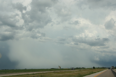
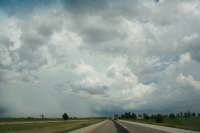
Approaching our storm from the north near Normal, Illinois.

Approaching the storm of the day south of Normal, Illinois.

After Iowa’s blue-sky bust on June 18, yesterday provided some welcome and much-needed activity. Between illness and May’s ridge of steel, my chase expeditions this year have been limited. The Edina, Missouri, tornado of May 13 has been my only tornado to date for 2009. Yesterday did nothing to improve that statistic, but it did offer a vigorous, classic supercell with some great structure that ensured my 1,650-mile, two-day chase with my buddy Bill Oosterbaan wasn’t a complete washout.

For that matter, storms did finally fire in eastern Iowa, and while Bill and I were too late to catch the big mutha that slammed Prairie du Chien (Ben Holcomb, if you happen to read this, great job on tracking that beast into the hills and jungles of Wisconsin!), we did manage to latch onto the one that followed in its footsteps. But I’m no fan of night time chasing and neither is Bill, and knowing the kind of topography that lay to our east once we crossed the river, we dropped our chase at Prairie du Chien and found ourselves a hotel.

After a decent breakfast yesterday morning, we were on the road by noon and headed south. The SPC showed a moderate risk for a large area extending from Iowa and Missouri east across the corn belt and Great Lakes. With a continuation of yesterday’s huge CAPE and good bulk shear, a widespread severe weather outbreak seemed like a sure bet. However, veering surface winds and unidirectional flow seemed to put the kibosh on chances for tornadoes in all but a few areas to the east, where helicities improved, particularly around 21Z.

As we approached Davenport, Iowa, heading south, we could see towers muscling up along an east-west boundary that transected Illinois south of the I-80 corridor. Catching I-80 east, we could see new cells firing up farther to the south on GR3. With a Kankakee target in the back of our minds, we decided to drop toward Normal on I-39.

By the time we drew near the town, the northernmost storm was showing rotation on the radar. The tower was just to our west, and as we proceeded down the highway, the updraft base came into view, dominated by a well-developed wall cloud.

Wall cloud on northernmost storm.

Wall cloud on northernmost storm.

We headed for an intercept, tracking with the storm until it began to degrade. Meanwhile, another cell to the south was strengthening and beginning to exhibit distinct rotation on SRV, so with the storm we were on mushing out, we abandoned it in favor of the second, rapidly intensifying supercell.

One heckuva hail shaft or what?

One heckuva hail shaft or what?

This bad boy had an impressive hail shaft, if hail is what we were actually seeing. Maybe it was just plain old rain with a bit of hail mixed in. The reason I wonder is because of the paucity of hail reports. We got tapped a bit as we closed in, but mostly we just encountered buckets of rain. Whatever the case, the updraft tower with the sunlit precip column was a beautiful sight.

Second storm showing hail shaft and updraft tower.

Second storm showing sunlit precip core and updraft tower.

After working our way south of the storm’s rear flank, we proceeded east and finally gained some good, clear views of the business end. Tracking with it from near Urbana through Homer, Fairmount, and Westville toward the Indiana border, we were in a good position to enjoy the structure as the storm went through several cycles.

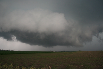
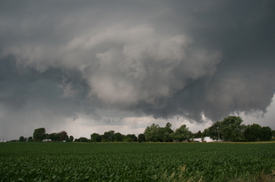
Rotating wall cloud.

Rotating wall cloud.

Just east of Homer, the wall cloud tightened and I could see rapidly circulating cloud tags descending toward the ground. We pulled over to watch. The rotation wasn’t far away–maybe a quarter of a mile–and it appeared to be moving toward us. This was strange as we were southwest of the wall cloud, but you can’t argue with a developing tornado. With the updraft approaching to within a couple hundred yards of us, Bill seemed intent on analyzing why the storm was acting so peculiarly, while I favored beating a hasty retreat and working out the behavioral aspects of storm circulation from a somewhat greater distance. Storm chasing sure has its interesting moments.

No tornado materialized, the storm headed east, and we continued on with it. I noticed a couple of tornado reports from around Fairmount and Westville, but while I suppose it’s possible that there was a brief spinup or two, Bill and I never saw an actual tornado. We did witness a few times when the wall cloud began to torque  pretty intensely, and I sure wouldn’t have wanted to be directly below it.

The whitish wall cloud is half a mile from us and rotating vigorously.

The whitish wall cloud is half a mile from us and rotating vigorously.

Possibly a funnel cloud at this point.

Possibly a funnel cloud at this point.

But from the time we first intercepted it to the point where it finally began to fizzle 120 miles later west of Crawfordsville, Indiana, the storm was outflow-dominant. Never once did we enounter surface inflow, though above ground level, I’m sure inflow was strong. In Bill’s words, the circulation kept reaching toward the ground, looking for something to grab onto, but it never could manage to root and produce a tornado. If we’d had backing winds…if the helicities had been there…I’m sure the storm would have been a potent tornado breeder. It never got its act together in that regard, but I doubt the communities in its path felt terribly disappointed, and from my perspective, the storm provided an interesting chase with some very nice moments.

Last gasp: wall cloud at US 41 west of Crawfordsville, Indiana, shortly before the storm began to collapse.

Last gasp: wall cloud at US 41 west of Crawfordsville, Indiana, shortly before the storm began to collapse.

For sheer structure, the “Danville supercell” was interesting and photogenic, with some nice RFD slots wrapping in, and, toward the end of the storm’s career, with a classic, stack-of-plates mesocyclone that was as nice as anything I’ve ever seen. (Sorry, no photos–the ones I have didn’t turn out well.)

One downside to this chase–and it is a big one–is that somewhere between Homer and US 41, I lost my camcorder. It wasn’t a pricey camcorder; it was a used Sony that I bought from my friend and fellow storm chaser Kurt Hulst. But it has done me good service over the past year, and I hate to think that it is presently sitting out there by the side of some Illinois backroad. What’s even worse is, my video of this chase is in it.

The drive back to Grand Rapids was a long one. I arrived at my apartment around 2:30 a.m. and collapsed. The chase was fun and I think I needed it, but it’s good to be back home with the love of my life, Lisa, whose bright eyes and beautiful smile warm my heart wherever I travel.