Waterspout Season Opens Today on Lake Michigan

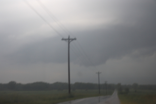
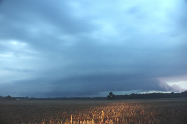
When I saw the clouds this afternoon, I couldn’t help but wonder. Lisa and I were catching a late lunch–or an early dinner, take your pick–at the Fire Rock Grille, and I was staring out the window over the golf course at low-topped convective towers to my northwest. The sky had that look about it that spoke of stripped-out moisture and cold mid-level temperatures, as you begin to expect around this time of year, and I thought, “If those towers were over Lake Michigan, there’d be a waterspout hanging from one of them.”

My first successful waterspout chase last year led me to believe that when conditions are right for spouts–when cold air moving over warm lake waters creates steep low-level lapse rates and enough vorticity is present to get stretched by an updraft–then the main thing to do is get one’s butt down to the lakeshore and look for convective bands. Maybe I’m being overly simplistic; regardless, September 22, 2012, made me a believer in the feasibility of viewing Lake Michigan waterspouts. I even managed to get some shaky but very cool video that day of a spout making landfall about one hundred yards north of me.

My instincts today proved right, but the action occurred on the other side of the pond, where some spectacular photos and video came from lucky beachcombers in Kenosha, Wisconsin. I normally avoid embedding YouTube videos in my posts because I never know how long one will remain viable, but I’m displaying this one by Jeff Magno because I find it particularly intriguing.

Not only is the distant spout massive at this point, but look at how the mist rising off of the sidewalk in the foreground forms a tracer for the surface winds. The mist rushes southward, consistent with today’s northerly flow, but where it rises, you can see it begin to move lakeward. It dissipates far too quickly to tell much of a story, but it leads me to speculate about the low-level vertical vorticity that may have been available to produce the spouts.

But then, what do I know about these things? I’m just a happy observer when I get the chance to be one–which, as it turns out, may be tomorrow morning. Got a hot tip on that, so I’m setting my clock and planning to wake up early, and tonight I will dream of near-shore convection.

Jazz Jams in Grand Rapids

Something is happening with jazz in Grand Rapids. Overnight, it seems, the art form which hitherto has garnered lots of respect but little support is coming into its own in this area. People are turning out to hear live jazz. It has been a long time coming, and it’s good to see.

Last night I went to a jam session at the Winchester, located at 648 Wealthy Street SE. Running from 9:30 to 12:30, the session is hosted by trumpeter Chris Lawrence, with John Shea on keyboards and a rotating lineup of bass players and drummers. Besides being an incendiary improviser, Chris does a splendid job fronting the session, and he has an enthusiastic audience. A number of great area jazz musicians showed up to share their talents, among them veteran drummer Scott Veenstra, vocalist Kathy LaMar (she’s a marvel!), and keyboard wizard Steve Talaga.

Steve arrived after wrapping up his own earlier jam session down the street at Billy’s in Eastown. I haven’t made it to that session yet, but it’s on my list. Like the one at the Winchester, it’s new, and it amazes me in the pleasantest way that, suddenly, not just one but two Tuesday night jazz jam sessions have emerged right down the road from each other. Steve’s runs from 7:00 to 11:00 p.m. at 1437 Wealthy. A guest musician could close out that session and then, if so inclined, head over to the Winchester and still have plenty more time to play.

Both of the Tuesday sessions are recent and very welcome developments, and the Winchester and Billy’s are to be saluted for supporting them.

But that’s not the end of it. Across town on Sunday nights is where the session with a history to it takes place. At SpeakEZ Lounge, 600 Monroe NW, well-known drummer and harmonica man Randy Marsh hosts this town’s longest ongoing jam session. The session began a couple years ago at HopCat, where it ran for quite a while before moving to SpeakEZ. The second location is an excellent venue for Randy, who rotates a consistently topnotch cast of section players and provides a welcoming setting for visiting musicians to air out their chops.

Blowing sessions are a part of the jazz tradition, and to see them emerge and succeed here in Grand Rapids seems to me a litmus test of the state of the art. West Michigan has got some world-class musicians as well as a heap of upcoming talent, and I’m delighted to see room being made for all.

I have an idea that there’s a link between the explosion of craft beer in this town and the ascendance of live jazz. Beer–good beer–is art, and artists recognize and support other artists. In a town that has been named Beer City for two years running in the Beer City USA national poll, and which in recent years has also garnered national attention for its three-week-long, citywide ArtPrize contest, a new and positive mindset toward things aesthetic has become apparent, and it is sweeping up jazz into the mix. Bravo for those restaurant owners who see value in live jazz and are choosing to support it by giving it a venue in their establishments.


May 28, 2013, Tornadic Supercell by Grand Ledge, Michigan

Tornado season is now long past, and the sting of missing great storms either through bad targeting or having to head home one and two days before two major events has eased. Maybe next year will be better. Besides, the show’s not over till the snows fly.

Meanwhile, I’m looking back to my most interesting chase of the year, documented by the video at the bottom of this post. Ironically, I logged around 6,000 miles to and from Oklahoma and Kansas with little to show for it, while my humble backyard of Michigan gave me an enjoyable and productive bit of action.

On May 28, a warm front lifted up through lower Michigan, ushering in decent moisture and instability along with a good boundary for them to work their mojo with. The thing that seemed to be missing was adequate shear for storm organization–but I ignored conditions farther east of me. I just didn’t take the setup seriously enough, and when Kyle Underwood, the WOOD TV8 meteorologist, inquired which of the TV8 chasers planned to head out, I said that I didn’t see much potential. If something came my way, I would grab it, but otherwise, I didn’t want to waste gas. That was understandable: money was tight, and I planned to chase in Kansas the next day. Still, geeze, what an idiot (me, not Kyle).

Let us pause momentarily while I give myself a retroactive dope slap. I have come to a conclusion: in Michigan, when a warm front shows up with good CAPE present and any kind of bulk shear to speak of, even anemic bulk shear, chase the front. Never mind what the models have to say about storm-relative helicity; helicity will take care of itself if a storm manages to organize in the vicinity of the frontal boundary. Just get out there and chase the stupid front. Particularly farther to the east. Storms in Michigan often have a way of intensifying and organizing near and east of I-69 and, north of Lansing, US-127.

That was the case on this day. My first clue was when I glanced at the radar later and noticed that Kurt Hulst was on a storm off to the southeast. Kurt knows what he’s doing, and the storm looked decent–in fact, it was tornado-warned. Okay, I thought, I missed that one. Probably it’ll be the only one. So I sat tight and watched the radar as other storms formed. They looked like a convective mess to my west, but they clearly were moving into a better environment as they progressed east. Finally, I’d had enough. I grabbed my laptop and cameras and headed out.

I locked onto the most intense-looking cell in my vicinity and tracked with it toward Portland. But another was following on its heels, and given the way that the storms were behaving, I thought I’d be better off dropping the one I was on and letting the new one come to me. Presumably, it would get its crap together on the way, and that is what happened.

As it approached Grand Ledge just west of Lansing, this storm developed a most amazing streamer of scud sucking into its updraft base from the east. It appeared to originate near ground level–hard to tell with trees constantly interrupting the view–and rocketed toward the storm, leaving no doubt that this storm had impressive inflow.

Driving into Grand Ledge, I found myself under the area of rotation, with crazy, low cloud motions. Turning around, I headed back north and parked by the airport, then watched and filmed as the storm headed east into Lansing. It looked very close to spinning up a tornado; in the video, you can see it trying hard, and eventually it succeeded.

But I had to drop the chase. My friend Steve Barclift and I planned to chase the next day in Kansas, and I had to meet him so we could hit the road for the long drive west. As it turned out, the storm I was on provided a better show than anything we saw along the dryline. My buddy Rob Forry managed to catch this storm at its tornadic phase and got some nice video.

My original hi-def shows the motion of the inflow streamer nicely as I enter Grand Ledge. Regrettable, this YouTube clip doesn’t render the details as well, but you’ll at least get a feel for the motion. The storm was an interesting one and fun to chase. It would be nice to get another one like it. It’s only August, so the door is far from closed.

June 12 Chase in Northwest Indiana and Michigan

There’s nothing fancy about these pics. They are what they are. But after a tremendously frustrating May–a rant I won’t even bother to get into right now–it is nice to have at least something to show.

The setup was a warm front strung from Iowa eastward across northern Indiana, typical of the south-central Great Lakes region. While the NWS was talking of a derecho, forecast soundings a couple days in advance seemed to point to tornadic potential. And indeed, on the day-of, the SPC issued a high risk across the area, with a 10 percent hatched tornado risk in the area where Kurt Hulst and I chased and a 15 percent hatch farther to the west.

6122013 Meso NW INThe photos show what we came up with in northwest Indiana south of Koontz Lake. The first blurry shot is of a small mesocyclone on a storm which, on the radar, gave only small hints that it could harbor one. Sometimes, given the right environment, what base reflectivity renders as amorphous blobs can provide surprises where you find a little sorta-kinda-almost hooky-looking little notch, and that was the case here.

For a minute, it actually looked like it might give us a tornado, but the lack of surface winds was a good clue that wasn’t gonna happen. Structurally, though, this little storm offered an interesting opportunity to try and read clues in the clouds as to what it was doing or planned to do. I’m not sure I ever did figure that out, but it was fun to watch.

6122013 Meso S of Koontz Lake INAfter watching it for several minutes, we dropped it to intercept the larger, more robust cell advancing behind it. This storm had displayed prolonged rotation on radar, and as we repositioned near a broad stretch of field that gave us a good view, we could see a stubby tail cloud feeding into a large, flange-shaped meso. The storm was clearly HP, with a linear look to it that suggests a shelf cloud, but there was no mistaking the broad rotary motion, and you can make out some inflow bands in the picture. At one point, a well-defined funnel formed just north of the juncture with the tail cloud (or whatever you want to call it) and the  rain core, drifting behind the core and into obscurity.

We played tag with this storm for a while, but it was toward sunset and getting darker and darker, and eventually we decided to call it quits and head back. The storms where we were just lacked the low-level helicity to go tornadic. There was ample surface-based CAPE–somewhere in the order of 3,000 J/kg, methinks– but whatever inflow was feeding them appeared to be streaming in above ground level.

So we headed back into Michigan, and as we drove north on US-31 near Saint Joseph, things got interesting fast. Green and orange power flashes suggested that a high wind was moving through nearby. A glance at the radar and, sure enough, there it was: a bow echo. It didn’t look terribly dramatic on radar, but looks can be deceiving.

Heading east on I-94, we attempted to catch up with the belly of the bow as it rocketed toward Paw Paw and Kalamazoo. The next fifty or sixty miles was a millrace of frequently shifting high winds and torrential rain punctuated by power flashes. At one point, we narrowly missed running into a highway sign that blew across the road in front of us. At another, we passed an inferno where a falling tree had evidently gotten entangled in a power line.

North of us on the radar, we could see a supercell moving over the town of Wayland. But it was a little ways beyond reach, particularly given the kind of backwoods territory that lay to its east.

The high winds and driving rain ended, ironically, as we entered Kent County. My little hometown of Caledonia got just a relative dusting of rain and maybe a zephyr of outflow. It was hard to believe how much drama was playing out just a few miles to the south.

Big thanks to Kurt for taking me out with him when I didn’t have the gas or the money to chase on my own. I needed to get out and chase, and the sneering irony of having a robust setup dropped in my backyard and not being able to do anything about it was really eating me yesterday. I got to go out after all, and it felt wonderful.


A Crummy Storm Season and an Upcoming Video Tutorial on Circular Breathing

Well over a month has elapsed since my last post. I look at the date of that post, April 1, and think, Right. April Fool, everybody. It sure fooled me.

My exuberant expectations for this storm season, particularly compared to last year’s, have fallen so far short that they’d need to climb a step ladder just to be upside-down. Last year by this time, I’d at least gotten in two productive chases, one of them spectacular and the other decent. This year, nada. I didn’t think it was possible to have a worse chase season than 2012, but 2013 is demonstrating just how a wrong a man can be.

Now, I know what everyone says: you can’t judge the latter part of a season by its early part. I believe that. The past has proved how dramatically things can change. Chase seasons that started out crappy suddenly shaped up and started cranking out some great setups. I hope that proves true with this one. As it stands, my traditional target date of May 22, nigh sacred to me for the great chases it has provided, has been consistently flatlining on the GFS. That long-range model has me gazing wistfully at its the far, far end, willing for a shadow of hope to show up at 384 hours and remain hopeful–a nice, robust trough that survives successive runs and moves through the timeline into the Plains, where–you’ll say I’m dreaming–it actually overlays moisture and instability.

There’s actually such a shadow lurking in this morning’s GFSM. I don’t trust it, no sir-ree, not at all. Yet I hope it will show better integrity than its predecessors. Regardless, I’m crossing my fingers for late May and June.

As for this blog, its inactivity is due a depressing lack of anything stormy to write about. Oh, yeah, there was the history-making April flood that put a number of Michigan communities underwater and came within inches of overflowing the floodwalls in downtown Grand Rapids. I heard of a golf course on the southwest side of town that was under four feet of water. That’s not something you see every day around here.

So I made a point of going out and snapping some photos in my own neck of the woods along the Thornapple and Coldwater rivers. The 84th Street dam on the Thornapple was like a giant firehose, the jewel-like Coldwater Park was underwater, and a couple miles further east, vast acres of wooded floodplain had opened up to exploration by canoe. It was something to see, but I didn’t much feel like writing about it.

Fortunately, when the weather refuses to cooperate, music keeps me occupied. Last Thursday, Big Band Nouveau debuted at The B.O.B. in downtown Grand Rapids. We played our butts off and enjoyed an enthusiastic reception. I see great prospects for this band.

More immediately, I’ve been working on a video tutorial on circular breathing. In fact, I shot some video yesterday and uploaded it last night to YouTube, with every intention of posting it on Stormhorn.com today. But in reviewing it this morning, I realized that it wasn’t up to snuff. So I deleted it from YouTube. I need to do another video session before I can post.

In other words, everything you’ve just read is really a substitute for the post I had planned, featuring the video tutorial. That post is in the works, so consider this a heads-up, particularly if you’re interested in learning circular breathing.

That’s all for now. A full day of editing a client’s manuscript awaits me, and I’ve got to get to it. Sayonara.


Jazz Jams at Noto’s: An Interview with Guitarist Steve Hilger

Every other Thursday night, guitarist Steve Hilger hosts a jazz jam in the lounge of Noto’s Old World Italian Dining at 6600 28th Street SE. Located in the Grand Rapids bedroom community of Cascade in southeast Kent County, the restaurant is easily accessible from the main drag. There, from 7:00–10:00 p.m., Steve provides a topnotch rhythm section for jazz musicians to sit in with and air out their chops.

While seasoned players are always gladly welcomed, Steve is particularly interested in giving high school and college musicians the chance to perform onstage with a live band. That kind of opportunity doesn’t come often or easily in West Michigan. Thanks to the vision and persistence of well-known jazz veteran Randy Marsh, downtown Grand Rapids has had a jazz jam venue for the last two years on Sunday nights, first at HopCat and lately at Speak EZ. Now Steve offers a similar opportunity to the outlying southeast area, within easy reach of musicians in the Forest Hills, Caledonia, East Grand Rapids, Kentwood, Lowell, and Middleville school districts.

This is the kind of thing I longed for as a younger player–and as an older player, for that matter. Let’s face it, West Michigan is not New York or Chicago. There are plenty of musicians here but not many chances for them to get together informally and blow.  So the jam sessions at Noto’s are a boon to developing and even professional jazz instrumentalists and vocalists. The setting is one where parents can feel comfortable letting their teen musician hang out with other players, and the rest of the family will enjoy it as well if they wish to listen.

The sessions have gotten off to a slow start, but there’s plenty of reason for them to take off once area musicians find out about them. Word just needs to spread. So I’m doing my part with this post. I’ve had a blast sitting in with Steve and the guys, and I invite you to do the same if you’re a jazz practicioner.

And that’s enough from me. It’s time to hear from Steve.

_______________

Question: How long have you played guitar? Who are some of your influences?

Steve: I started playing guitar in the eighth grade with a cheap nylon string classical guitar and a borrowed Peter, Paul, and Mary songbook. I started with “Don’t Think Twice, Its Alright.” I actually learned the finger picking before the strumming.

My influences are many. I am a fan of a lot of different types of music including jazz, blues, acoustic folk, rock, and classical. Some of my influential guitar players include Carlos Santana, Eric Clapton, and Stevie Ray Vaughn. I would have to say that the most influential was Carlos Santana, because even as a kid, I marvelled at his melodic lines. It was not the number of notes he played that mattered, but which notes he played.

Yet musically overall, my influences are more from horn players such as Miles Davis, John Coltrane and Charlie Parker. Miles Davis was another example of playing the right notes instead of a lot of them.

Q: You’ve had your own bands for quite a while now, and you’re well-established in the Grand Rapids and West Michigan music scene. How did you get started?

S: In college, I had a friend who I started a band with. We wrote our own tunes and eventually recorded them in a studio in New York. The music took a back seat while I was raising a family and starting a legal career. After a divorce, I rekindled my lifelong passion of guitar playing and song writing. Nothing quite like a divorce to inspire you to write lyrics.

I went into the studio in 2005 to record some of the new tunes, and then we performed them live at the 2007 Grand Rapids Festival of the Arts. Shortly after that, we started to play blues and started performing around town.

Q: You started with a blues band. More recently you formed a jazz combo. What led you to diversify?

S: Ever since I heard Miles Davis’s “Kind of Blue” shortly after it came out, I was fascinated by jazz. Then, in the mid-70s, when The Allman Brothers put out “Live at the Fillmore East,” I discovered the blues. I’ve always loved both genres. So when I realized I had a blues band full of really talented jazz musicians, I decided to do both and started a jazz band as well.

Q: You and veteran drummer Randy Marsh are doing your utmost to uphold a vital tradition of jazz: the jam session. Randy hosts a Sunday evening session at Speak EZ in downtown Grand Rapids. You host one at Noto’s in Cascade every other Thursday, and you’re particularly interested in encouraging high school and college musicians to participate. Why are you doing this and what would you like to see happen? What do younger musicians get out of a jam session that they can’t get other ways?

S: When I was in high school in a small town thirty-six miles west of New York City, I played trumpet in the school jazz band. Our band leader played gigs in New York City and was pretty well known as a trombone player. She was able to attract top talent to come to our school and give clinics. I do not remember all of them, but I specifically remember Count Basie and Doc Severenson.

That was a huge opportunity, and it would be nice to pass it on in some small way. Student musicians need a chance, and have the right, to make mistakes. Once they get past the fear of failure, they can start to experiment, learn, and develop confidence which carries over in all aspects of life. If, for as long as I do this, I am able to reach one student in this fashion, all the effort will be worth it. Young musicians really need a place to come out and give it a go.

Q: You provide a unique tie-in between the Noto’s jam session and the selection of young musicians for this summer’s GRandJazzFest. Please tell us about it.

S: Every other Thursday, my jazz trio, TrioJazz has been performing at Noto’s. We thought that Noto’s would be a good venue for students to sit in and work their chops on jazz improvisation.

I am on the selection committee for musical acts for the 2013 GRJazz Festival. The Board thought it would be a good idea to have students participate in the festival, and we needed a way to reach out to jazz students to see who was willing and able to perform. It’s part of the GRJazz Festival’s commitment to include education as part of its goals. The Thursday night Noto’s gig provides a perfect opportunity to find student jazz musicians who might play in the festival.

The Noto’s gig is really the only way I will get the chance to meet student musicians in the community. And if a young musician feels they did not do as well as they would have liked on a given night, they can always come back and try again. There is no point-scoring here. While we hope to pick some of the top students to participate, everyone who comes out and plays is a winner in their own right. We will be selecting five or so musicians who will be given a chance to jump on the big stage at the jazz festival to showcase their talents.

Q: It can feel intimidating for a high school kid to set foot onstage and play with professional musicians. But you and your musicians are hugely encouraging and love to have younger players sit in. Talk about what a student can expect when they walk in with their instrument. Do you have any advice for them?

S: They and their family can expect a casual, wholesome setting and a warm welcome. They can listen as long as they want, assemble their instrument when they feel ready, and then play the tune or tunes of their choice.

My first piece of advice is, relax. Have fun! Enjoy the moment. Nobody is scoring anything here and you have nothing to lose. All of us started out at some point. So pick a tune, preferably out of the Real Book, or bring charts, and let’s see if we can have some fun!

Q: Jam sessions aside, what are you striving for personally in your own growth curve as a musician?

S: I strive to be the best musician I can be. That applies to all the music I play. I practice a lot.

One common experience among many musicians, me included, is that you always hear other musicians who do something better than you. What you don’t realize is that you yourself do some things better than anyone else. I remember an interview with a jazz great who was so disappointed with a solo he played because he hit some wrong notes, or so he thought. Then he noticed that everyone who was following him started playing those wrong notes because the “wrong notes” had now become hip. So I am always listening, always trying to get better, always trying to hear what other musicians are doing to see if there are any take-away things I can do or use.

Q: A steady diet of nothing but music makes for a great player but a narrow life. You own your own law firm, and I know that you absolutely love what you do. What other interests and activities do you have which round you out as a person?

S: First and foremost, my interests are my three wonderful kids and the lovely Deborah Richmond. They are the foundation of my life.

I truly enjoy my work and the firm I started and have helped to grow. We have great partners and a wonderful group of clients.

I am also an avid photographer and have traveled throughout the United States on photography trips, focusing mainly on nature, wildlife, and landscape photography. I have published articles and photos, and started all that as a news photographer in the late 1960s when photographers were somewhat of a novelty.

For many years, I traveled the country competing in archery, which ended in multiple state and national championships, records, and even the 2004 Olympic trials. Now, my son and I are into the shooting sports such as skeet and big-bore, long-range rifle shooting.

Presenting Big Band Nouveaux

Beginning with the new year, I’ve spent a number of Monday nights practicing with West Michigan’s newest (that I’m aware of) jazz venture: Big Band Nouveaux. Under the leadership of Grand Rapids tenor saxophonist Michael Doyle, this band is a collective of top-drawer jazz musicians that absolutely kicks butt.

Some months ago, Mike contacted me about a project he had up his sleeve. Would I be interested in participating? Mike is a great musician, so naturally he immediately got my attention, but I have to confess that when he mentioned big band music, I felt lukewarm. The big band format has never been my passion. Nothing against it, but I’ve always leaned toward smaller combos: more freedom, more flexibility, more interplay between musicians. That’s just my preference.

But Big Band Nouveaux is a different breed. It is unquestionably the most incendiary big band I’ve ever played in, with great charts that offer plenty of room for soloists to stretch and with some tremendously talented musicians in the lineup: Paul Lesinski, Fred Knapp, Isaac Norris, Louis Rudner, Mark Wells, and Arnaldo Alcevedo, just to name a few. Veteran Blue Lake Radio jazz announcer Lazaro Vega is honing his trumpet chops with the brass section; our fearless leader, the man in the pork pie hat, Mike, is playing first tenor; and Tyler Beer and I are making the alto sax charts happen. The arrangements are uber-hip, and playing with this ensemble has been more fun than I ever imagined.

Last Monday we recorded some demo tracks for the band. (Big thanks to Paul Lesinski for bringing in his recording equipment and then doing the mixdowns during the course of this week. Great job, Paul!) And I know that Mike is doing his best to hustle up some gigs for the band. We’ve still got our work cut out for us in terms of building our repertoire, but keep your eyes out for this molten-hot outfit. It will be making the scene in the coming months, and you definitely want to catch it when it hits the clubs.

Winter System Hits the Midwest and Great Lakes

As I write, a 988 mb low is passing just south of me, and with it, a major winter storm is covering areas west of me with snow while in the Southeast, several states are under a 5 percent risk of tornadoes per the Storm Prediction Center.

I’m not going to write a lot. I just want to tip my hat to this system as it moves through, because it is a humdinger. Here in Grand Rapids, we’re presently getting a lot of wind and rain, and the rain will change to snow later tonight.

Snowfall here looks to be minimal, an inch or less, but not a whole lot farther north, conditions promise to worsen quickly, with accumulations up to eight inches or more over the next 24 hours. The first map is a 12Z NAM snowfall map, courtesy of F5 Data; click on it to enlarge it. Below it, to demonstrate the contrasting weather conditions, is the SPC Day 1 tornado risk.

An Interview with Wade Szilagyi, Director of the International Centre for Waterspout Research

It has been far too long since I’ve posted in this blog. Since my last post on my first-ever Lake Michigan waterspout intercept–and an amazing intercept it was, at that–waterspout season has come and gone, and Hurricane Sandy has wreaked damage of historical proportions on New York City and the New Jersey coastline. But, caught up in editing projects, I haven’t had much energy for writing my own stuff.

I have had a couple things up my sleeve, though, both musical and meteorological. This interview is one of them, and I think you will find it worth the wait. It features Wade Szilagyi, founder and director of the International Centre for Waterspout Research (ICWR) and developer of the Waterspout Nomogram and the Szilagyi Waterspout Index (SWI). Wade is not only at the cutting edge of waterspout research and forecasting, but he drives and defines much of it. I’m pleased and honored to have him as my guest.

Born in 1963 in Toronto, Ontario, Wade moved to Whitby in 1973, where he currently resides. He graduated in 1987 from the University of Toronto with a degree in atmospheric physics and was hired by the Canadian federal government as a meteorologist that same year. He worked as an operational meteorologist until 2001, when he moved into the National Service Operations Division as a national coordinator for program development and standards. Wade has published several articles and research papers on the topic of waterspouts and forecasting. He has also appeared on various media outlets discussing the topic of waterspouts, including interviews on The Weather Channel and Interlochen Public Radio and a writeup in Newsnet5.com.

Wade has two sons who are now in university. One is taking criminology and the other, mechanical engineering. Their father says, wryly, “I couldn’t convince them to go into weather!”

Wade likes to stay active. “I am very big on health and fitness,” he says. “I love to dance, bike, kayak, and power walk. I am a big believer in self-improvement and strive to be strong in mind, body, and soul.”

With that background on Wade the person, I now present to you Wade the waterspout researcher. I think you will find he has some fascinating things to say.

Question: Let’s start with the question that I’m sure is burning in everyone’s curiosity: How do you pronounce your last name? Give us the phonetic spelling.

Wade: Sa-la-gee

Q: Please tell us how you first became interested in meteorology.

W: It all started in grade eight science class. We were doing a unit on weather; however, the passion didn’t hit me until the end of the chapter. One of the chapter questions was to construct a weather observation table. My table consisted of weather parameters such as temperature, relative humidity, cloud cover, wind velocity, etc. I took weather readings and entered them in the table twice a day. I thought I would do this for a week; little did I know that it would last for five years!

Much came from those tables: graphs were produced, trends analyzed, and a climatology for my home town was initiated. This finally culminated with the entry of my project in the science fair in grade 13, for which I won second prize. I still remember teachers bringing their students past the displays. One teacher didn’t believe that I was dedicated enough to take weather readings twice a day every day for five years. He accused me of making the readings up. In my defense, I told him to talk to my teacher, who had known me for several years.

Q: You serve as director for the International Centre for Waterspout Research as well as with the Weather Office of Environment Canada. Please tell me a bit about your training and experience as a meteorologist.

W: The training as a meteorologist begins at university. There are different routes one can take in order to satisfy the requirements to become a federal government meteorologist. One must have a BSC degree in meteorology, atmospheric physics, or a combination of math and physics. I chose the atmospheric physics route. After graduating, I was hired by the federal government and took a mandatory year-long operational forecast training program. This is where one learns how to forecast the weather. After graduating, I was sent to the Toronto Weather Centre, where I remained for ten years. At this office I produced various forecast products such as aviation, public, marine, fire weather, and specialized products. Eleven years ago, I left the Weather Centre and went to the National Services Division, where I am a program manager for weather standards.

Q: One thing I immediately picked up on in talking with you is that you are utterly enamored with waterspouts! Clearly your knowledge of them has been fueled by genuine passion and fascination. When and how did waterspouts first capture your interest, and what has been your path as a foremost waterspout research scientist? Who has been influential along the way?

W: As with many discoveries in life, my interest in waterspouts came about by accident. Originally, I was investigating the phenomenon known as “arctic sea smoke.” This forms over open bodies of water at very cold air temperatures. Arctic sea smoke was a problem at one of our airports on Georgian Bay; it would frequently reduce the visibility near the runway.

I started looking into how to forecast arctic sea smoke. On days when arctic sea smoke occurred, I went down to Lake Ontario to gather data. By accident, I noticed several transient swirls forming in the sea smoke. These are called steam devils, and I quickly became interested in them. On one occasion I saw a huge steam devil. I called it a “winter waterspout.” It was at this point that my fascination with waterspouts began.

At the time, little was done in the way of waterspout forecasting. Weather centers would issue a Special Marine Warning (U.S.) or a Waterspout Advisory (Canada) only after a waterspout was sighted. On one midnight shift, I said to myself, “We are forecasters. We should be able to predict waterspouts.”

I began gathering meteorological data during waterspout events in order to develop a forecast technique. A couple of years later, the first version of the technique, the Szilagyi Waterspout Nomogram, was developed and used at the Weather Center in Toronto.

Over the years, as more data was gathered, the Nomogram was improved. Recently, I developed the Szilagyi Waterspout Index (SWI), which is based on the Nomogram. From the SWI, and with the help of my colleague, my dream of developing the world’s first operational waterspout forecast model was achieved during the summer of 2012. Waterspouts can now be predicted with confidence up to two days in advance!

The Nomogram and SWI are now used at weather centers around the Great Lakes and on both coasts of North America, and they are now being investigated in other parts of the world, especially Europe. During this period, I have written several articles and research papers and have given media interviews. I also formed the International Centre for Waterspout Research (ICWR) in 2008, which is a non-governmental organization comprised of research scientists, meteorologists, storm chasers, etc. from around the world who are interested in the field of waterspouts.

Regarding who has been influential along my waterspout research path, I would have to say Dr. Joseph Golden. Dr. Golden is considered the “father of waterspouts.” He spent most of his career studying waterspouts and how they form. I was honored to have met Dr. Golden at the Great Lakes Operational Meteorology Workshop in Traverse City, Michigan, back in the 1990s.

Frank Kieltyka, a meteorologist from the Cleveland Weather Office who conducted waterspout studies over Lake Erie, was also influential in the early days. Internationally, Dr. Alexander Keul, from the Vienna University of Technology, and Michalis Sioutas, from Meteorological Application Centre in Greece, inspired me to work on joint international research projects and to establish the International Centre for Waterspout Research.

Q: I first came across your name as the author of a brief 2009 paper titled A Waterspout Forecasting Technique. In it, you described four types of waterspouts—thunderstorm-related, upper low, land breeze, and winter—and offered three significant parameters for forecasting them. Presumably, thunderstorm-related waterspouts evolve through processes familiar to storm chasers. But the remaining three are less familiar. Would you briefly describe the conditions that produce them and what distinguishes them from each other? Do any of them have a land-based equivalent?

W: As a correction to the article, “thunderstorm-related” should be “severe weather.” Severe-weather-type waterspouts, like tornadoes over land, are associated with mesocyclones.

The other three types of waterspouts (upper low, land breeze, and winter) are categorized as fair-weather-type waterspouts. These form in a different manner than the severe-weather-type waterspouts. There are no mesocyclones associated with fair-weather-type waterspouts. In all three cases, circulation with fair-weather-type waterspouts starts at the surface of the water. As air rapidly moves upwards under the cloud, the circulation gets stretched upwards and forms a waterspout. What distinguishes the three fair-weather types is the weather pattern in which they form. Upper low waterspouts form under unstable conditions associated with what meteorologists call upper lows—large areas of cool, rotating air. Upper low waterspouts form any time of the day or night.

Land breeze waterspouts form along convergent lines called land breezes. Land breezes form overnight under light wind conditions as warm air rises over the water and is replaced by cooler air from the surrounding land. This cooler air converges along a line over the water, and it is along this line of converging air that rotation is initiated and waterspouts form. Land breezes last until early afternoon, at which time the waterspouts dissipate.

Winter waterspouts form when it is very cold and windy. This results in extremely unstable conditions over the water. However, winter waterspouts are rarely observed because lake effect snow obscures their presence.

The land-based equivalent of the three fair-weather-type waterspouts is a phenomenon known as the landspout. Landspouts form in a similar way as fair-weather-type waterspouts.

Q: You encapsulated the three chief parameters for forecasting waterspouts in the Szilagyi Waterspout Nomogram, which was the precursor to the Szilagyi Waterspout Index (SWI) and the ensuing colorized forecast maps for Great Lakes waterspouts. Those appear to be the first practical tools ever devised for forecasting spouts. Starting with the Nomogram, would you tell us how you developed them and exactly what they are? What improvements do you anticipate for the forecast maps?

W: Back in 1994, I started investigating what meteorological parameters correlated well during waterspout events. I wanted these parameters to be easy to calculate for forecasters. Three parameters satisfied these conditions of good correlation and easy use.* I then plotted these points and noticed that they formed a concentrated cluster on the graph. I enclosed the cluster with two lines. These lines are called the waterspout threshold lines. If a calculated point falls within them, waterspouts are likely. Outside the lines, waterspouts are not likely. This is what constitutes the Nomogram.

The Szilagyi Waterspout Index (SWI) is derived directly from the Nomogram. The purpose is to produce an index that can be used in computer algorithms to produce forecast maps of waterspout potential. The SWI ranges from -10 to +10. Waterspouts are likely for SWI ≥ 0. The new Experimental Waterspout Forecast System (EWFS) produces forecast values of SWI.

Improvements to the forecast maps produced by the EWFS are planned. These improvements include a higher model resolution, simplification of the display, and most importantly, the incorporation of surface convergence. Surface convergence is essential for waterspout formation.

Q: I understand that waterspout formation has five stages. Could you describe them? In a phone conversation, you mentioned to me that the presence of even a small funnel cloud means that a waterspout is already in progress, with circulation between the water surface and cloud base fully established. Most storm chasers are careful to distinguish between a funnel cloud and a tornado; they define a tornado by either the condensation funnel making full contact with the ground or else with visible rotation at ground level, typically verified by whirling dust or debris. How do you view this approach based on your experience with waterspouts?

W: Dr. Joseph Golden was the first to identify the five stages of a waterspout. These are:

1. Dark spot. A prominent circular, light-colored disk appears on the surface of the water, surrounded by a larger dark area of indeterminate shape and with diffused edges.

2. Spiral pattern. A pattern of light and dark-colored surface bands spiraling out from the dark spot which develops on the water surface.

3.Spray ring. A dense swirling ring of water spray appears around the dark spot with what appears to be an eye similar to that seen in hurricanes.

4. Mature vortex. The waterspout, now visible from water surface to the overhead cloud, achieves maximum organization and intensity. Its funnel often appears hollow, with a surrounding shell of turbulent condensate. The spray vortex can rise to a height of several hundred feet or more and often creates a visible wake and an associated wave train as it moves.

5. Decay. The funnel and spray vortex begin to dissipate as the inflow of warm air into the vortex weakens.

Regarding reporting either a waterspout or funnel cloud, the same procedure should be followed as with observations over the land. Evidence of a spray ring, or a fully condensed funnel reaching the surface of the water, should be visible before reporting it as a waterspout. If there is no spray ring visible because it is too far away to be viewed, and if the condensation funnel appears incomplete, then it should be called a funnel cloud.

Q: This year has been a record-breaker for waterspouts, bolstered by such landmark events as the September 21-24 Great Lakes outbreak. What has the ICWR gained, and what do you expect it to get, from this year? In your organization’s research overall, have you made any discoveries that have surprised you?

W: This year’s record-breaking waterspout numbers have resulted in tremendous media attention for the ICWR (e.g. The Weather Channel). This media attention has resulted in more individuals submitting waterspout reports on our website, which we display.These reports are also used to update and improve the nomogram.

A discovery that has surprised us at the ICWR is that the nomogram can be applied in other areas of the world, in particular over European waters. These observations were confirmed in a recent research paper.

Q: Speaking of the ICWR, how long has it been in existence? What led to its formation, and what is the story of its growth? What are some of its significant achievement? What are some things you’d like to see it accomplish within, say, the next five years, and who besides yourself are the players?

W: Founded in 2008 by me and two European colleagues, the ICWR is an independent non-governmental organization comprised of individuals from around the world who are interested in the field of waterspouts from a research, operational, and safety perspective. Originally conceived as a forum for researchers and meteorologists, the ICWR has now expanded interest and contribution from storm chasers, the media, marine and aviation communities, and from private individuals. The goals of the ICWR are as follows:

    • Foster the advancement of waterspout research and forecasting.
    • Provide an international forum for the exchange of information among researchers and meteorologists.
    • Facilitate the reporting of waterspouts from around the world from storm chasers and other interested individuals.
    • Promote, educate, and communicate to academic institutions, the media, marine and aviation communities, and private individuals.

Some of the achievements of the ICWR have been to jointly produce waterspout research papers. Another achievement has been the increase in public awareness of waterspouts around the world. Features on the ICWR web site called the “Live Waterspout Watch”, as well as the ICWR Facebook page have helped facilitate this public awareness.

Some projects that are currently being undertaken, and which I hope will be completed in the next five years, are the Global Waterspout Forecast System (GWFS), Global Waterspout Database (GWD), and Global Waterspout Watch Network (GWWN). The GWFS will produce waterspout potential maps for the entire globe. The GWD is a database containing waterspout events from around the world. The GWWN is a global network of waterspout spotters.

The ICWR is comprised of a director (me), as well as an executive committee. The executive committee has two representatives: Dr. Alexander Keul, from Salzburg University; and Michalis Siatous, meteorologist with the Greek Weather Service. The ICWR is also represented by a growing number of storm chasers, meteorologists, and research scientists.

Q: Are there any ways that storm chasers, weather observers, and other interested parties can participate in or otherwise assist the work of ICWR?

W: Yes. Storm chasers and weather observers can contact the ICWR and become part of the GWWN. Researchers and meteorologists can collaborate with the ICWR to produce joint research papers or develop forecast models.

Q: How many waterspout incidents have you personally witnessed? Are there any that stand out as particularly memorable for you?

W:I have seen waterspouts on five separate occasions. The most memorable one was the first time I saw them. I rented a cottage for a few days on the north shore of Lake Erie. The weather was warm and the hope of seeing any waterspouts diminished with each passing day. On the last day of the vacation, I stopped thinking about waterspouts. That morning the weather was cool. I went out onto the beach with my glass of orange juice and was looking around the sand. I looked up over the water, and to my amazement I saw a family of three waterspouts in a row! My jaw and the glass dropped. I ran into the cottage yelling, “Waterspouts!” My wife told me that I was like a kid in a candy store. I grabbed my video camera, and for the next fifty minutes I filmed several waterspouts forming and dissipating.

Q: When you’re not researching waterspouts, what do you like to do? Got any hobbies that keep you occupied when the spouts aren’t spinning?

W: Hey, waterspout research is my hobby! My other hobbies are archeology and treasure hunting, which I have been doing for the last twenty-six years. I have found several artifacts that have added to the knowledge of the history of my town. These artifacts go on display to the public at various events. I am also planning on creating a virtual museum. I should point out that one of my greatest dreams is treasure hunting on the beach while looking up and seeing a waterspout!
_______________________

* The three parameters are as follows: (1) The difference between water temperature and 850 mb temperature; (2) the depth of convective clouds; and (3) the 850 mb wind speed, which must be less than 40 knots. For further information, Szilagyi refers readers to his article on waterspout forecasting.

Waterspouts on Lake Michigan

Saturday, September 22, was the first day of autumn 2012. It was also my first-ever time seeing waterspouts. I’ve chased them a few times (if chased is the right word) previously within the past two years, but not successfully. This time made up in spades for those occasions. I don’t know how many waterspouts I saw, but “lots” ought to cover them, including one that made landfall about a hundred yards north of me at Tunnel Park. I managed to capture that one on video. But I’m getting ahead of myself.

I woke up at 5:15 a.m., showered up, and headed for the lakeshore. The ICWR waterspout forecast indicated a high probability of waterspouts all along the eastern shore of Lake Michigan, and the main concern seemed to be simply finding adequate near-shore convection. That didn’t seem to be a problem, since a line of thunderstorms was moving across the lake from Wisconsin and heading east almost straight at me. Based on the line’s slightly southern component, I decided to head for Holland Beach.

A nice cumulus field had overspread West Michigan as I pulled into the state park. At the entrance, a ranger informed me of restricted parking due to a marathon that was being routed through the park by the beach. The racers hadn’t yet arrived; in fact, very few people were present, and having the parking lot mostly to myself, I chose an optimal spot where I had an unimpeded view of Lake Michigan.

The stiff lake breeze concerned me. Westerly surface winds–and strong ones at that–didn’t seem to me to bode well for waterspouts. How would the convergence necessary for spout formation occur over the water with unidirectional winds? Still, the waterspout index was maxed out, and here I was, so I guessed I would find out.

After a while, the western sky began to darken. The storms were moving in, but they would take a while to arrive. Meanwhile, a green blob of convection on GR3 corresponded with a cloud bank stretching perpendicularly from the waters to the shore about ten miles to my south. It seemed worth checking out, so I grabbed my camera and headed across the beach toward the pier near the lighthouse. From that vantage point, I finally got a good, complete view of the convective band.

A slim, well-defined gray tube hung from the distant cloud base. Bingo! My first waterspout! I began snapping pictures.

The salmon run was on, and all along the channel, fishermen were having a heyday. Focused on fish, they seemed oblivious to the elegant spectacle unfolding over the water. How could they not see it? I pointed it out to one fisherman. “Wow! A waterspout!” he said. Then he went back to his fishing. To each his own, though I suppose he could fish and watch the spout at the same time.

I don’t know how much time passed–fifteen minutes, maybe twenty. By and by, the spout dissipated, and I returned to my car. I didn’t need to look at my radar to know that the storm was closing in. I could see the lowering clouds and rain shafts over the water.

What the radar did tell me, however, was that heavier convection was heading toward the Saugatuck/South Haven area. So, as the first of the marathoners began to trickle into the park, I decided to drop south toward where chasers Skip Talbot, Jennifer Ubyl, and Jonathan Williamston were located.

I got as far as US 31 before realizing that I had made a tactical error. Heavier convection was beginning to fire in a line that promised to train in directly over Holland Beach. Nuts. I had just compromised myself by fifteen minutes, and in the meantime, a marathon had gotten underway. I turned around and headed back toward my old location, but now the road was filled with runners and closed to traffic.

I decided to head for Tunnel Park just a few mile north of Holland Beach. But Lakeshore Drive was also clogged with marathoners. Thus began a frustrating quarter-hour of driving down sideroads and through neighborhoods, trying to gain access to the lakeshore. Ultimately, I wound up pulling over kitty-corner across the road from the park entrance, watching morosely as runners ran by. But there was a cop standing next to his car, shepherding the crowd, and … what the heck. I walked up to him and asked him if I could cross into the park. Sure, he said. The race ended officially right at this point. Just look for an opening, the cop told me, and then I could nudge my car across the road.

Free!

The storm was arriving as I pulled into the park, and rain had begun to fall. I grabbed my cameras and raced toward the tunnel. The other end opened out onto the beach, affording a sheltered location where I could watch for spouts without getting wet. It was a perfect setup.

The only other people there at the park were a young ethnic couple with a baby and a small child. I greeted them and talked with them about waterspouts as we watched a shelf cloud advance over the storm-driven surf. After a few minutes, the guy pointed toward the lake and said, “Is that one?” I looked, figuring it was a false alarm, some turbulent scrap of scud ascending along the shelf cloud. But no, he was pointing at the water, where a rotating patch of spray was clearly visible. It was only a couple hundred yards away, small but unmistakable. Waterspout!

And now another, larger one was organizing to my northwest. I could see no funnel, but then, the shelf cloud was now almost directly overhead, and features that might have been obvious at a distance were lost in the jumble of clouds. Regardless, the rotating cascade looked intense. I grabbed my camcorder. There was no time to set up the tripod; I would have to manage the best I could with hand-held. I hit “record” and began shooting the waterspout as it progressed toward the shoreline.

At first, it appeared to be heading toward us, which didn’t concern me. The waterspout was non-tornadic, and while it obviously packed some strong winds, I felt that the greatest threat it posed was a nasty sand-blasting. We could retreat into the tunnel if necessary.

But the spout made landfall about one hundred yards to my north. I ran out onto the beach to try to capture more of it as it progressed up over the foredune, but I was too late, and that section of my footage turned out pretty wobbly. Still, I had about forty-five seconds of shaky but ultra-cool footage of a Lake Michigan waterspout hitting the shore at close range. The first thirty seconds is the best, but I’ve chosen to show the whole shebang because I think there are some points of interest in the latter part, flawed though it is.

Back at my car, the radar indicated more intense convection headed toward Grand Haven. After sending a report to Spotter Network, I got onto Lakeshore Drive and began heading north. The stream of runners had thinned out, and the road was open, though still patrolled by the police. A little ways north of the park entrance, I noticed a “damage path” of tree trash–clusters of leaves and large twigs–scattered across the pavement. The road was only a quarter-mile from the shore, and I have no idea how far inland the waterspout made it before dissipating, but I suspected that a few runners had gotten quite a surprise.

Up at Grand Haven, a cloud bank to my northwest put down a series of spouts. These were much farther offshore and not particularly impressive at the time I viewed them, though I’ve seen some stunning photos by another spout chaser from the same location. After a while, the waterspout activity dwindled off, but I’d gotten my fill and was glad to head back east.

Back in Grand Rapids, I processed my video of the spout at Tunnel Park and attempted to send it to WOOD TV8. But the ftp upload failed, so rather than waste more time, I stopped by the station and let their tech handle things. The footage got aired on the evening news.

After that, I somehow wound up in Lowell. It was a lovely, moody day, perfect for the first day of fall, and I guess I just felt like a drive. Anyway, I found myself on the waterfront, watching ragged cumulus clouds drift over the broad, windblown face of the Flat River. To the north, a small, low-top storm billowed up above its less successful convective comrades and spread its cirrus anvil eastward. It was a beautiful sight, as was the entire sky, and I couldn’t resist taking a few more pictures. The last view on this page looks to the south, where the Lowell Showboat rests at its dock just upstream from the Flat River Grill and the dam beneath the startlingly blue September sky.

And that is that. Two days later, the same intensely azure sky prevails and this chill wind testifies that autumn is indeed at hand. The trees are still mostly green, but change is in the air. My hunch is, we won’t be getting a “second season” for storm chasing. If not, Saturday was wonderful compensation and will see me through to next spring.