Bow Echo at Elk Rapids, Michigan

Judging from the forecast soundings, it seemed that northern Michigan stood at least a chance of tornadoes yesterday evening. But the storms that first ignited in Wisconsin quickly congealed into a broken line as they crossed Lake Michigan, minimizing their tornadic potential and fulfilling the predictions of forecast models and the knowledgeable heads at the Storm Prediction Center.

I made the trip north regardless of, from my standpoint as a storm chaser, the unpromising prognosis. I hadn’t been upstate yet this year, I was itching for a bit of convective violence in any form, and the thought of simply watching a brooding shelf cloud blow in over the beautiful hills-and-water region around Traverse City appealed to me. Given ample low-level helicity between 200-300 m2/s2, I figured I stood at least a chance of getting  some rotation out of a tail-end cell or perhaps a hook-like protrusion. But I was willing to settle for less, which is what I expected and what I got.

I headed north on US 131 as far as Kalkaska. Then, with storms to both my north and west, I decided I’d be better off heading west down SR 72 and meeting the southernmost cells moving in toward Traverse City.

At Acme, I caught US 31 north, and from then on my goal was to find a good place to park and get some pics. That’s easier said than done in a landscape filled with timber. Grand Traverse Bay was almost within spitting distance, and I could see glowering, lightning-laced clouds advancing to my northwest. But, blocked by trees, the clear view I envisioned of a shelf cloud bulldozing in over the bay kept eluding me.

Finally I found myself in Elk Rapids. The town was right on the water; there had to be someplace to park with an open view.

At a stop sign, I edged out prematurely, then tapped on the brakes as fellow chaser Nick Nolte turned off the main drag in front of me. Cool–Nick was here too. I figured I’d find a spot, then give him a call. As it turned out, Nick found me first a few minutes later in the parking lot of the local marina.

“Hey, I just about ran into you at an intersection,” I told him.

“That was you?” he said. “Jerk!”

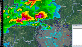
Our location was probably as close to ideal as possible, given the lay of the land. The cell to our north blew past, but the radar indicated a bow echo making its way directly toward us. I’d never have guessed from the bland-looking sky to the west. But in a few minutes, storm features began to emerge from the nondescript grayness like an old Polaroid photograph developing. A shelf cloud was advancing across the bay, growing more distinct by the second.

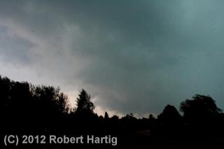
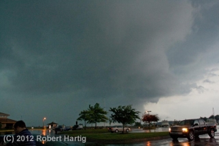
Nick hopped out of his car and tripoded his camera. I opted to go hand-held–not the best approach, but in this case a practical one. But my camera gave me grief; the shutter wouldn’t operate, and by the time I remembered that I needed to turn off the auto-focus, the shelf cloud was overhead. Nuts. I snapped the five shots you see below, then got in my car as the rain and wind descended in earnest.

The marina was right in the belly of the bow, and for a few minutes, I enjoyed a nice blast punctuated with lightning and commented on by thunder. Then the line moved off to the east. Nick and I decided to try and reposition in hopes of intercepting the southern end, but our attempt was futile. We ended the chase and grabbed dinner at a Big Boy restaurant in Kalkaska.

This time of year, any storm is a good storm–not that I’ll normally drive 175 miles just to see a bow echo, but I don’t need a Great Plains tornado to make me happy. After multiplied days of remorselessly gorgeous weather, a boisterous round of lightning and thunder always gladdens my heart and gets a shout out of me.

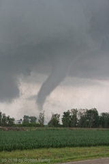
ADDENDUM: The tail-end cell, which had consistently displayed a hook-like appendage and shown an inclination to turn right, went on to produce an EF-1 tornado at a golf course near Roscommon, forty miles east-southeast of where Nick and I grabbed dinner in Kalkaska. The low-level helicity delivered after all. If the storms had been discrete, I suspect we’d have seen a few more tornado reports.
June 9, 2012, North Dakota Chase Bust: Buy My Elephant

You can’t find a more quintessential border town than Pembina. It’s the last US town on I-29 before you hit Canada two miles to the north; and just across from it, on the eastern side of the Red River of the North, lie Minnesota and Pembina’s border-town twin, Saint Vincent. Tucked away in the northeast apex of North Dakota, Pembina is as far poleward as you’re ever likely to chase storms in the continental United States unless you find yourself pursuing wedges around Angle Inlet, Minnesota.

Last Saturday afternoon, Rob Forry and I gassed up at a filling station on the western edge of Pembina and contemplated the sky with fellow storm chasers Jim Parsons and Brian Spencer. The forecast models had been painting a frustrating picture, with a surface low moving northeast up into Manitoba and dragging southeast winds with it, leaving those of us without passports–which included me–with helicity-killing southwesterlies by the time storms started firing later in the day.

However, the HRRR was offering a glimmer of hope, stalling the warm front across the northernmost counties and maintaining southeasterly winds slightly south of the border as late as 01z. So there we were in Pembina in the mid-afternoon, gazing at a patch of altocumulus. On the way up, we had passed through an outflow boundary from storms earlier that morning, and now a brisk northeasterly wind reminded us that we had left the warm sector behind us.

The four of us grabbed lunch at a local restaurant, then parted ways. Most chasers were congregated well to our south near Devil’s Lake, where previous forecast soundings had looked pretty compelling. Unquestionably, instability would be present. Helicity and capping were the question marks, and even as we backtracked southward and then west, I had a hunch that we would eventually wind up playing back to the north.

In the tiny prairie town of Edmore–how do people earn a living in such remote places?–Rob and I found a shady place to park and wait for things to develop. We had passed back across the frontal boundary, and the temperature was warm, the winds were blowing from the southeast, and overhead, billowing towers kept thumping against the stout cap. We hung out in our new location for maybe half an hour with John and Brian, who had rejoined us, then took off. During that short time, the surface winds had veered to the south, so we headed back north on SR 1 to where the winds were once again blowing from the southeast and then parked.

Ten or fifteen minutes passed. A dot materialized far down the road to our south and grew larger, expanding and dividing into two rapidly approaching vehicles. It was our friends Ben Holcomb and Adam Lucio, in company with a small group of other chasers I had never met. They pulled aside and we all stood around and yakked for a while. Ben was suffering from a nasty ear infection which had hit him the previous night, and while he had managed to score some antibiotics, he was still pretty miserable. But with a friend visiting him from Finland for the express purpose of chasing storms, he was sticking doggedly with the chase. Must come from having lived all those years in Michigan, where a chaser’s character is shaped by supercell deprivation.

We hung with Adam, Ben, and their crowd for a while, then continued north. The surface winds had once again veered, and surface obs showed them blowing from the south-southwest not very far south of us. It seemed to me that if we were going to have any chance at all of seeing a tornado–and admittedly, chances were slim to begin with–it would be along the northern tier of counties in the instability axis.

At the town of Langdon, we headed west, and it wasn’t long afterward that we witnessed a tower finally break through the cap directly overhead and blossom into a full-fledged storm. We tagged with it for a few minutes, but with just a couple miles between us and the border, we didn’t have much room to play with, so we let it go for the chasers in Canada to try their luck with.

Meanwhile, another storm was intensifying to our south, and we headed east to intercept it. From there on, storms began to multiply, but there’s no point in going into detail. The cloud bases were higher than I had expected; the ambient surface winds, which had been brisk all day, seemed to sigh away into nothingness; and the storms were outflow-dominant and just garden-variety severe. Rob and I encountered a little half-inch hail, and at one point a nearby CG which I never saw struck behind me, producing a LOUD thunderclap that sounded like a rifle shot and scared the crap out of me.

But it wasn’t the severity of the storms that made this trip memorable. It was that minimalist landscape stretching its sameness in every direction out into infinity; and it was the dome of the sky, spreading its cerulean canvas from horizon to horizon over tiny communities scattered far apart across the prairie. There, a thousand miles from my Michigan hometown and over 100 miles farther north than the northernmost point of the Keweenaw Peninsula, that sky-canvas, daubed by the Great Painter with the texture and tincture of clouds and light, rendered the panoramic emptiness of North Dakota dramatic and beautiful.

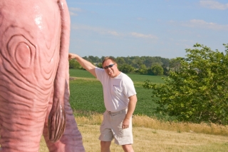
The drive back on the following day was predictably long and, for the most part, uneventful. These last two photos mark what was probably the highlight of the return trip (barring dinner at a truly fabulous sushi restaurant in Janesville, Wisconsin). Rob snapped them for me at a gas station somewhere in Wisconsin or maybe Minnesota, I forget where. But the place wouldn’t be too hard to find again. It’s probably the only gas station in America that has a sculpture of a life-size pink elephant wearing black glasses standing at the edge of the parking lot.

Naturally, Rob and I both needed to pose in front of so imposing a creature, and it wasn’t until I processed the pics afterward that I noticed the realtor’s “For Sale” sign on the left. Really, though, it’s my sign. Would you like to buy my elephant? I’ll make you a great deal. It’s a very nice elephant, well-behaved and in excellent health except for a slightly embarrassing digestive disorder for which I’ve found no remedy other than to … well, you can see how I’ve handled it.

Memorial Day 2012: A West Michigan Lightning Extravaganza

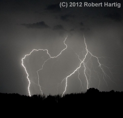
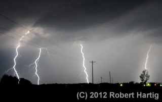
I have yet to take some truly razor-sharp images of lightning, but each time I go out, I learn a little more about how to improve my lightning photography. Last night afforded me a great opportunity. Storms forming ahead of a cold front moved across Lake Michigan and began to increase in coverage as the night progressed, and I roamed with them across West Michigan from the shoreline at Whitehall and Muskegon State Park to inland northeast of Lake Odessa.

My expedition was marred by the fact that I left the adapter plate for my tripod at home. I compensated by setting my camera on top of my dashboard and shooting through the windshield, an arrangement that works okay but

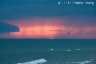
which considerably limited what I was able to do at the lakeshore. Using the hood of my car to steady myself, I managed to capture a few shots of a beautiful, moody sunset, with the red semicircle of the the sun gazing sullenly through rain curtains of the advancing storms. However, parking by the side of a busy road where everybody had the same idea–to pull over and watch the storms roll in over the waters–just didn’t work very well. After too many time-lapse images marred by tail lights (see photo in gallery below) I decided to hightail it and try my luck inland.

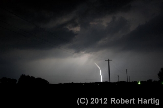
It was a good choice. The storms multiplied as I headed back toward Caledonia, and with lightning detonating to my north and closing in from the west, I decided to continue eastward till I found an ideal location–a place far from city lights and with a good view in all directions. I never expected to drive as far as northeast of Lake Odessa, but I’m glad I did.

Note to self: STOP USING THE ULTRA-WIDE-ANGLE SETTING WHEN SHOOTING LIGHTNING. Zooming out all the way to 18 mm is just too far, and cropping the shots doesn’t work well. The crispness goes downhill.

For all that, the images below aren’t all that bad, and a few turned out really well. After Sunday’s busted chase in Nebraska, it was nice to enjoy a few mugfulls of convective homebrew right here in West Michigan. I finally arrived home at the scandalous hour of 4:15 a.m., far later than I ever anticipated. I was tired but pleased. This Memorial Day lightning display did not disappoint.

Along the Long Lake Trail

This has been the quietest May I can recall weatherwise. The peak month that I and hundreds of other storm chasers have spent the better part of a year anticipating has turned out to be a dud. Maybe around the latter part of the month things will improve, but there’s nothing to look forward to for at least the next week.

If the weather isn’t going to offer anything chaseworthy, then the way it has been is exactly the way I want it to be: blue, crisp, and beautiful, warm but not hot, with the sun smiling down on a landscape that’s getting on with the business of spring.

A couple days ago, I took a walk down the Long Lake Trail just north of Gun Lake State Park in northern Barry County’s Yankee Springs Recreational Area. It had been a while since I had hiked the trail, and this time of year is perfect for the venture, so off I went. The first mile or so of the trail winds through hardwood forest, skirting a small bog and a tract of red pine, then sets you on a quarter-mile stretch of boardwalk through part of the swamp that surrounds Long Lake. It’s a lovely hike that offers plenty to see if you know your native plants and their habitats.

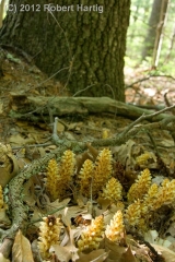
Here are a few of the highlights. The odd little plant to your right, which somewhat resembles miniature corncobs, is called squawroot (Orobanche americana). It is a common woodland plant, parasitic on oak trees. Click on the image to enlarge it.

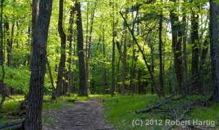
The trail winds through some particularly pretty territory. The photo below gives you an idea. There are a number of other images at the bottom of this page to keep it company.

Ferns were in the process of unrolling their fronds. They never look more dramatic or more artistic than this time of year, when they’re in their “fiddlehead” stage.

Farther down the trail, where the boardwalk commences, marsh marigolds scattered Pointillistic fragments of butter-yellow across the swamp floor. Picking up on the golden theme, the first few flowers of small yellow ladyslipper orchids (Cypripedium calceolus var. parviflorum) peeked out shyly from among lush skunk cabbage leaves.

The swamp is full of poison sumac, a small tree with which I’ve had considerable experience recognizing and avoiding. It is related to the cashew and also, of course, to poison ivy. Eating poison ivy at age six was not one of my intellectual zeniths, and it’s not an experiment one should undertake casually. Long after the initial bitter burst of flavor has faded, the experience lingers in a way a body is not apt to forget. Word has it that poison sumac is even more virulent than poison ivy. That’s not something I care to put to the

test. Interestingly, the sap of its equally toxic cousin, the Japanese lacquer tree, is used as a varnish which produces some beautiful objets d’art, though how a body works with a medium like that is beyond me.

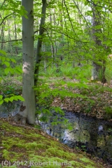
But enough of the swamp and its sumac. Stepping off the far end of the boardwalk and farther into the woods, I encountered an elegant young beech tree standing sentinel on a mossy bank.

I walked a bit farther, then turned back. The slanting sun rays were filtering long through the leaves, the temperature was cooling, and it was time for me to go practice my horn–which, by the way, I’ve been doing pretty consistently. But that’s material for another post. Right now, check out the rest of my photos in the gallery below.

Picking Up the Horn Again after Being Sick

Thursday evening, April 12, I left Grand Rapids to go chase storms out west. It was a great time and a successful chase, but on the way home Sunday night I began to cough, and the cough blossomed into the worst case of bronchitis I’ve ever had. For two weeks, I languished. My activity was limited to coughing, and coughing, and coughing some more; prostrating myself before the vaporizer for extended inhalation sessions punctuated by periodic steamy showers; slurping down massive quantities of fluids; and sleeping like I never planned to wake up and didn’t want to (which, indeed, I didn’t).

Over the past three days, I’ve finally begun to feel human again. Today I woke up feeling pretty good, with just a remnant of a cough and my voice returning to some semblance of its normal self. What a relief!

Naturally, I was pining to get at my saxophone. Three weeks away from it is way too long. I’d been in top form when I left for Oklahoma and Kansas, and now I’ve got some ground to recover.

So this evening I grabbed my horn and headed to my beloved railroad tracks, where it’s my wont to park my car, work over my horn, and wait for the trains to roll by. Out by a crossing near the rural community of Alto, I assembled my beautiful Conn 6M Ladyface and began to blow the rust out of my fingers and the cobwebs out of my head.

It felt so good!

There is something about reuniting with my saxophone after an extended period away from it that feels at once awkward, restorative, frustrating, cathartic, and encouraging. The awkwardness and frustration come from having spent enough time not playing my instrument that it feels a bit foreign to my hands, not quite the comfortable extension of me that it normally is. My technique isn’t as smooth, and material I had recently been practicing has to be called back to memory. The encouragement arises with the discovery that, hey, I don’t sound all that bad, regardless. In fact, I sound pretty good. Something about the time away seems to tap into reservoirs of creativity I didn’t realize existed, and if my playing isn’t quite as facile as I’d like, there’s nevertheless a compensatory freshness to it. My fingers don’t fall as readily into the same glib patterns, and so instead they find their way toward new ideas.

As for the restorative and cathartic aspects of picking up my saxophone after a lengthy period of illness, do I really need to explain? It’s just such a marvelous feeling to play again, to experience the physicality of making music: the balanced resistance and give of the reed in conjunction with my airstream, the feel of the keys beneath my fingers as I practice patterns and craft spontaneous melody lines. There’s nothing like it.

With the arrival of spring weather, I’ve been pretty consumed with storm chasing. The chase season is here for a limited time, and one must make the most of it while the opportunity is there. But the musical part of me doesn’t at all go dormant during storm season. I prioritize chasing over musical engagements, but not over the music itself. I continue to practice and push myself as a saxophonist, even if the bulk of my blog posts during this season focus on severe weather.

Tonight I’m taking a hiatus from the weather to reflect on this other part of myself, the musical part. How good it feels to play! Thank you, Lord, for the gift of music–for this amazing instrument you’ve placed in my hands, and for the passion and the drive to continue striving for the mastery of it. It is such a joy to play my horn once again!

First Plains Chase of 2012 Coming Up

I headed this afternoon to my tax man’s office with a sense of dread and walked out with glee in my heart and a refund coming to me from the IRS. Sweet! Just what I need to help finance my storm chases this year. I am due for some good ones. Last year I was miserably sidelined while my friends pounded the highways during a spectacular, albeit tragic, tornado season. This year, God willing, I’ll witness some beautiful tubes and breathtaking structure drifting across the vast sublimity of the Great Plains. March 2 was a mind-blowing start. Now I hope to capture my next round of video in a few days.

I won’t bother with talking about forecast models and such right now, though you can bet I’ve been keeping my eyes on the GFS and the Euro, and now the NAM. The big thing is, instability, moisture, and shear all seem to be lining up nicely. So Thursday evening I’ll be heading for the convective manna-land of the West with my buddy, Bill Oosterbaan. Joining us will be a friend of his from across the state as well as Steve Barclift, an editor from Kregel Books who shares my love of storms and has been wanting to chase a few of them with me. Hopefully this weekend will provide both of these guys with a great introduction to the science, the art, the craft, and the awe of storm chasing.

I am so looking forward to chasing storms once again out on the prairie! At last! There is no other place on earth like the Great Plains!

‘Nuff said for now. Right now the other half of me–the jazz musician half–is calling out to me and demanding some time practicing my sax. Who am I to say no. I’m off.

Last Day of March: A Retrospective on One Really Weird Month

Here on this Saturday afternoon, poised at the tipping point into April, I look back on the past month and think, “What the heck was that?” March 2012 has been the oddest March I can recall, and if it is exiting like a lamb, it is not a very nice lamb. But at least it’s behaving more the way I’d expect it to. The first half of the month took the end of an abnormally warm winter to outlandish extremes, with record-breaking high temperatures across much of the nation. Here in West Michigan, not only did we consistently experience temps in the 70s, but we had a number of 80-degree days, one or two of which climbed perilously close to the 90-degree mark. For a while, it looked like we were emerging from the winter-without-a-winter into the summer-without-a-spring.

It was ridiculous, and to me, alarming. What kind of spring, to say nothing of summer, did such an anomaly presage? Would the nation wind up with another killer heat dome like last year’s, only maybe worse? Would the southern plains bake once again under an intolerable drought?

With the Gulf of Mexico’s moisture conveyor wide open, the lamb-like warmth of early March fostered some particularly leonine severe weather on March 2 in southern Indiana, Kentucky, Ohio, and other nearby states. It was the most lethal March tornado disaster since the 1966 Candlestick Park tornado claimed 42 lives.

As the warm spell continued, wildflowers bloomed in the woods a month ahead of schedule. Maples exploded into chartreuse and red blossoms, hyacinths decked themselves out in yellow, cherries and other flowering trees put on their finery, and hepaticas, spring beauties, and trout lilies sprinkled the forest floors with color, all weeks ahead of their normal season.

Now here we sit with flowers blooming and trees leafing out, and today’s temperature is forecast to hit the low 50s. Yesterday we almost got snow. The unseasonable warmth left us a week or so ago, and now March is acting like itself. Except, what’s with all these daffodils and pink plum blossoms?

The severe weather also seems to have regressed, which I suppose is just as well. I’m presently eyeballing what looks to be the next major trough, which according to today’s 6z GFS will swing into the plains Friday. At present, Saturday looks to have better potential, but at 180-plus hours out, there’s obviously a whole lot of wait-and-see involved between now and then. The system that is presently working its way through looked similarly promising a week ago, but it rapidly deteriorated into a poster child for why anything beyond three days out is just a prompt, not a forecast.

Anyway, right now, on this last day of March, I’m peering ahead and wondering: next Saturday, April 7? Maybe. Granted, I was entertaining similar speculations last week about tomorrow’s no-show. Still, it’s nice to have hit that time of year when the wildflowers are blooming, the robins are tugging worms out of the turf, and fools like me are once again gazing into the long-range crystal ball and thinking, “Hmmm…”

“We Had No Warning”

Welcome to tornado season 2012. It’s a reception that anyone but a storm chaser would no doubt prefer to decline, but there’s no getting around it. This abnormally warm March has already produced one prolific and deadly outbreak as well as several lesser tornado events. The Gulf conveyor is open for business, shuttling rich moisture into large sections of the continental United States, and with one system after another moving across the heartland, we appear to be moving into another active spring.

So let’s talk about what it will take to survive. If you’re a storm chaser, a National Weather Service or media meteorologist, or someone involved in emergency management, you can skip this post as it’ll be preaching to the choir. But if you’re the average John or Jane Doe, listen in:

On days when severe weather is imminent, YOU are responsible for remaining alert as if the lives of you and your family members depend on it–because that could very well be the case.

After virtually every tornado disaster, some survivor invariably repeats the age-old mantra, “We had no warning.” Journalists love it. Someone–the National Weather Service, emergency management, or somebody somewhere entrusted with safeguarding the public–failed to warn an unsuspecting community of looming danger. Once again, those charged with protecting lives and property failed miserably.

It makes great press, but it’s rarely true today. There are exceptions–the outrageous warning dereliction on the part of Saint Louis International Airport officials on Good Friday of last year comes to mind. Most of the time, though, the real problem is one of two things, or both:

  1. * people didn’t receive a warning in the manner they believed it should have come to them; or
  2. * they failed to take seriously the warnings that were issued.

Let’s consider each of these concerns.

People’s expectations of how they will be warned don’t match the reality of how warnings are disseminated.

.
I’ll preface the following discussion by saying that I am no operational forecasting expert. My knowledge is that of a layman, albeit an informed one, a storm chaser of over fifteen years’ experience, including, for the past year, serving as a media chaser for WOOD TV8. With that caveat dispensed with, let me begin by saying that virtually no significant severe weather event escapes the notice of the Storm Prediction Center (SPC) or National Weather Service (NWS) meteorologists. I’m not referring to rogue episodes that confound even the experts. Unforecastable events such as last week’s three tornadoes in eastern Michigan may have a devastating local impact, but they’re not in the same league as classic tornado outbreaks, which are preceded by conditions that meteorologists are able to monitor long before they ever mature. Potential severe weather events are normally scrutinized days in advance, and broadcast media such as The Weather Channel begin talking about them well ahead of time.

Big weather is invariably well-forecasted weather; the question is whether people pay attention to the forecasts. As a severe event moves toward day one, warning meteorologists do their utmost to heighten public awareness. With the advance of social media, weather watches and warnings go out through a wider variety of means than ever–TV, local radio, NOAA weather radio, civil defense sirens, Twitter, Facebook, media websites, and more. All that can be done is being done to disseminate timely, life-saving information to as many people as possible. Moreover, in a day when funds continue to be cut from its budget, the NWS continually strives to improve its warnings. The people there take their role as weather guardians very seriously.

The rest is up to the public. That’s you. It’s a matter of personal responsibility.

On days when severe weather is forecast–particularly when your area lies in or near a moderate or a high risk, and above all when a PDS (Particularly Dangerous Situation) has been issued–it is critically important that you maintain situational awareness.

If a credible source repeatedly warned you that your house was being targeted for a robbery one or two days hence, would you go about your life as usual when the day arrived? Of course not. You would be in a state of heightened alert and ready to take immediate action. That should be your stance on severe weather days. A tornado can take more from you in seconds than a whole busload of thieves can in an entire afternoon.

Don’t count on the tornado siren to sound. It may not if the power grid has been knocked out. Or you may not hear it if you’re too far away from it, or if it’s 3:00 a.m and you are sound asleep. Even if you hear the siren, you may not respond to it appropriately if you live in an area that gets warned frequently, to the point where residents have grown jaded from warning burnout. In any case, a civil defense siren is only one means of receiving warnings, and–take note–you should not depend on it as your primary source. Watch your local TV station, or check out their website, their Facebook updates, or their Twitter feeds. Or tune in to local radio. You have more warning options available to you today than ever before. Make use of them.

A NOAA WEATHER RADIO SHOULD BE AS STANDARD IN YOUR HOME OR OFFICE AS SMOKE ALARMS.

IF YOU DON’T HAVE ONE, GET ONE.

It’s 2:00 a.m., and you and your family are sound asleep. Throughout the day, TV meteorologists had been forecasting impending severe weather after dark, and later in the evening, a steady stream of severe thunderstorm and tornado warnings began to interrupt the programming. With your town lying on the eastern side of a tornado watch, you were concerned enough that you thought you’d remain awake for a while after everyone else went to bed, just in case.

But by midnight, the warnings were still off to your west by several counties. It was late, and you needed to be at work at 8:00 a.m. “Besides,” you told yourself, “nothing ever happens around here.” As you headed to bed, you noticed lightning flickering in the distance through the window, but it was still a long way off.

Now, two hours later, you and your family are all sleeping soundly as a violent, half-mile-wide tornado grinds across your neighborhood toward your house. You won’t be going to work in the morning after all.

Don’t let it happen. Outfit yourself with a weather radio. It’s one of your best weather-warning assets any time of day, and at night it’s your only line of defense. It can make a life-or-death difference for you and your loved ones.

Many people don’t take warnings seriously.

.
When the siren sounds, take cover. When the broadcast meteorologist or the weather radio tells you to seek shelter, do so. Unless you’re knowledgeable about how storms behave and have an informed grasp of exactly what the weather is doing relative to your location, head immediately for safety. Don’t go outside and gawk at the sky. Far too many tornado victims become statistics because they want to take a look before they take action. But tornadoes can materialize in seconds, and ones that are in progress can descend on you as swiftly as a hawk on a rabbit. While some may move at a turtle’s pace, others, particularly those in the early spring, may be racing along at 60 or 70 miles an hour or even faster. By the time your untrained eyes have informed you that you need to seek shelter, it may be too late. So don’t waste time–go to the basement or whatever safe place you’ve earmarked for severe weather. You do have such a place in mind, right? If not, take some time to plan where you’ll go.

Do not ignore warnings. Maybe you live in a place where you’ve gotten a lot of warnings that never materialized. The siren sounded time and again, but nothing happened. The warnings on TV and radio were all Doppler-based, containing language like, “A storm capable of producing a tornado is moving toward …” No matter. Take every warning seriously. Otherwise, the warning you ignore will be the one you’ll wish you had paid attention to.

Warning meteorologists are caught in a double-bind when it comes to radar-based warnings. When mets issue warnings based on radar-indicated circulation, they get accused of crying wolf when nothing happens. But if they fail to issue warnings because they lack ground proof, that’s when a tornado will drop out of the sky and wipe out a neighborhood, and the residents will complain that they had no warning.

Damned if they do and damned if they don’t: that’s the no-win scenario that warning meteorologists have to deal with. Since they are more concerned with protecting you and your family than they are with upholding their image, and since they are very good at interpreting radar data in the light of environmental conditions, they will rather play it safe than sorry. But the NWS and SPC, which continue to explore technological and sociological ways to improve the warning system, can only do so much; and your local broadcast meteorologists can only do so much. The rest is up to you.

Your safety is in your own hands.

.
It’s up to you to take warnings seriously and respond to them promptly. On days when severe weather has been forecast, it’s up to you to maintain a level of alertness that will enable you to take life-saving action even if you never hear a siren, see a warning on TV, or receive a tweet on your smartphone.

This year, more people are going to die in tornadoes. Some of the deaths may be unavoidable. When a large, violent tornado moves through a heavily populated area, as happened last year in Tuscaloosa, Alabama, and Joplin, Missouri, fatalities will sometimes occur even when people do everything right. But most deaths will be ones that could have been avoided had people taken proper precautionary actions.

Pay attention to the weather that is shaping up for your area days in advance. Equip yourself with a dependable means of receiving weather updates, including a weather radio for your home that can sound an alert 24/7. Take every warning seriously, respond to it immediately, and remain in your place of safety for as long as necessary.

THE RESPONSIBILITY IS YOURS. STAY SAFE THIS TORNADO SEASON.

March 12, 2012, West Michigan Supercell

Well, what do you know! My purely speculative ruminations a few days ago on some possible upcoming severe weather materialized. The NAM, which was odd-man-out among the various forecast models, proved in the end to have the best handle on today’s setup in terms of moisture and instability. Those mid-50s dewpoints it kept promising actually showed up–I took a read of over 56 degrees in Portage on my Kestrel–and so did sufficient instability, courtesy of clearing that allowed the sun to work its mojo over West Michigan.

Here was the setup, in brief:

• A mid-level low over Wisconsin directing southwesterly upper flow over Michigan.

• Diffluence overspreading the lower part of the state.

• A 70-knot 500 mb jet max nuzzling into the area.

• Below it, 45-knot 850 mb winds continuing to strengthen.

• A clear slot moving in from Illinois, breaking up the overcast from earlier storms into a nice cumulus field with room for decent insolation.

• From those same earlier storms, wet ground that contributed to the boundary-layer moisture.

• Adequate instability. From the afternoon’s SPC mesoscale graphics, it looks like we saw upwards of 500 J/kg MLCAPE–in the early spring, sufficient to get the job done.

• Low-level helicity in the order of 200-250 m2/s2–easily enough for tornadoes, though none were reported.

I expected to leave my place in Caledonia and head south toward Kalamazoo around 3:00 p.m. However, clearing was moving into southwest Michigan so rapidly, with an attendant, juicy-looking cumulus field, that at 1:30 I could no longer sit still. I grabbed my gear, gassed up and Rain-Xed up, and hit the road.

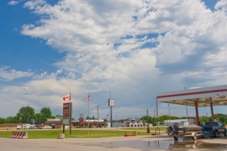
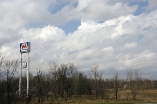
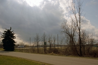
At the Marathon station on US-131 and 100th Street, I snapped a couple photos of the clouds while I waited for Tom Oosterbaan to arrive. In the topmost image, you can see how much shear was messing with the enhanced cumuli.

Once Tom arrived, we headed down US-131 toward Kalamazoo. On Center Avenue in Portage, south of I-94, we hooked up with Tom’s brother, Bill, and Dave Diehl. The four of us sat and waited, watching little storms on the radar pop along the lakeshore and head northeast and larger ones march across Grand Rapids and farther north.

Eventually, a vigorous cell that was moving in from around Benton Harbor continued to strengthen as it pulled closer to PawPaw. Cloud tops on this guy shot up rapidly as it moved toward us, and it began to take on that telltale supercellular look. This was our baby.

Bill took off west to intercept it directly in PawPaw. Tom and I headed north back up US-131, then caught M-43 west toward Bangor. A few miles down, a turbulent updraft base came into view. It was moving our way fast, and we decided that the better approach would be to jet back to 131, head north, and catch the storm as it approached and crossed the highway.

WOOD TV8 contacted me before we hit the exit ramp, and with my live stream going, a live phone-in underway, and an optimal view of a robust-looking wall cloud with a rather impressive tail cloud advancing from my west, pulling over onto the shoulder of the ramp seemed like my best move at that point. I did, and from what I hear, the live stream turned out really nicely on television.

As the wall cloud drew nearer, I took off once again, and we drew near to its southern edge as it crossed the highway, attended by a precip-filled RFD notch starting to wrap around it.

The storm was tearing along, and as it moved off to the northeast, I had a hunch that our day was over. We tried hard to catch up with the storm again, but it was moving too fast. Bill, on the other hand, had repositioned well off to the east and was in a prime location to intercept it. He did, and followed it a long way east. How he managed to keep up with it during its course through rural Barry County, which is some of the most unchaseable terrain imaginable, I’ll never know. (Actually, I probably do know–I’ve been on a lot of chases with Bill–but I ain’t divulging his secret, not me.)

After flirting briefly with another cell that blew toward us from Plainwell, Tom and I headed back toward 100th Street, where I dropped him off at his vehicle and then headed home.

This was a fun little local chase–less than 200 miles and nothing spectacular, but full of interest and a really nice way to kick off the spring storm season in West Michigan. Just for grins, here is a brief video clip of the wall cloud as it passed over US-131.

In Tribute to The Beatles

One of the marvels of YouTube is its videos of classic rock bands performing in the studio or in concert. Hendrix, Janis, The Who, Mountain, Jethro Tull … you can find them all, alive and kicking, in the prime of their youth and at the peak of their creative spark.

But among the icons of rock, one band towers above all the rest. In my estimation and that of many others, The Beatles were the progenitors of modern rock music, the importers of a British influence that took R & B in a different, electrifying direction. They were the watershed from which many streams have flowed. There may have been better instrumentalists in their day, but collectively the Fab Four were sheer genius.

Fortunately, The Beatles are well represented on YouTube. If I’ve seemed a bit effusive in my praises of them here, it’s because I just finished watching clips of the Beatles featuring two very different songs.

The first is an odd, artsy, vaguely disturbing video of the band members set in a dreamlike scenario filled with strange imagery. It’s an appropriate visual counterpart for the dark, richly textured John Lennon tune “Strawberry Fields Forever,” whose quirky, impressionistic lyrics, colorful orchestration, and shifting moods practically defined the psychedelic sound of the late 1960s. Whatever you consider “Strawberry Fields Forever,” it’s not rock and roll. It’s far too sophisticated for dance music. It is, in the parlance of those times, “a vibration,” something to be listened to, felt, and experienced.

On the other end of the spectrum is the video of the Beatles in the studio recording the visceral “Helter Skelter.” The tune is sheer, relentless energy. If “Strawberry Fields Forever” set the tone for psychedelia, “Helter Skelter” lit the fuse of heavy metal. I’d never have thought it of Paul, but seeing and hearing is believing. The man was a metal head before the term ever got coined. Small wonder that bands such as Aerosmith and Motley Crue covered the tune in their live concerts.

Speaking of which, I watched a number of other YouTube clips of various bands performing “Helter Skelter”: Aerosmith, Motley Crue, Bon Jovi, U2, even an older Paul McCartney. All of these groups offered some truly high-power performances. But the original Beatles version electrifies like nothing else. Maybe part of its impact lies in the simply seeing the guys playing together on the video and realizing just how much energy they generated. Whatever the case, the effect is incendiary.

The band’s impact continues to reverberate decades after their breakup in late 1969. While some of the commentary that attends the YouTube clips is what you would expect, I nevertheless find it gratifying to see how much reverence, if not outright adoration, is accorded the Beatles by so many listeners who weren’t even born until twenty and even thirty years after the recordings.

My apologies, by the way, for not including links to the YouTube videos mentioned in this post. Regrettably, such videos have a poor shelf life, and I consider it pointless to include links that are almost certain to wind up broken within a year or so.

I have no more to say about The Beatles tonight, largely because there is so much to say about them that it’s best to stop here and, um, let it be. It is late and I’m tired. Good night.